Webber Falls 2020

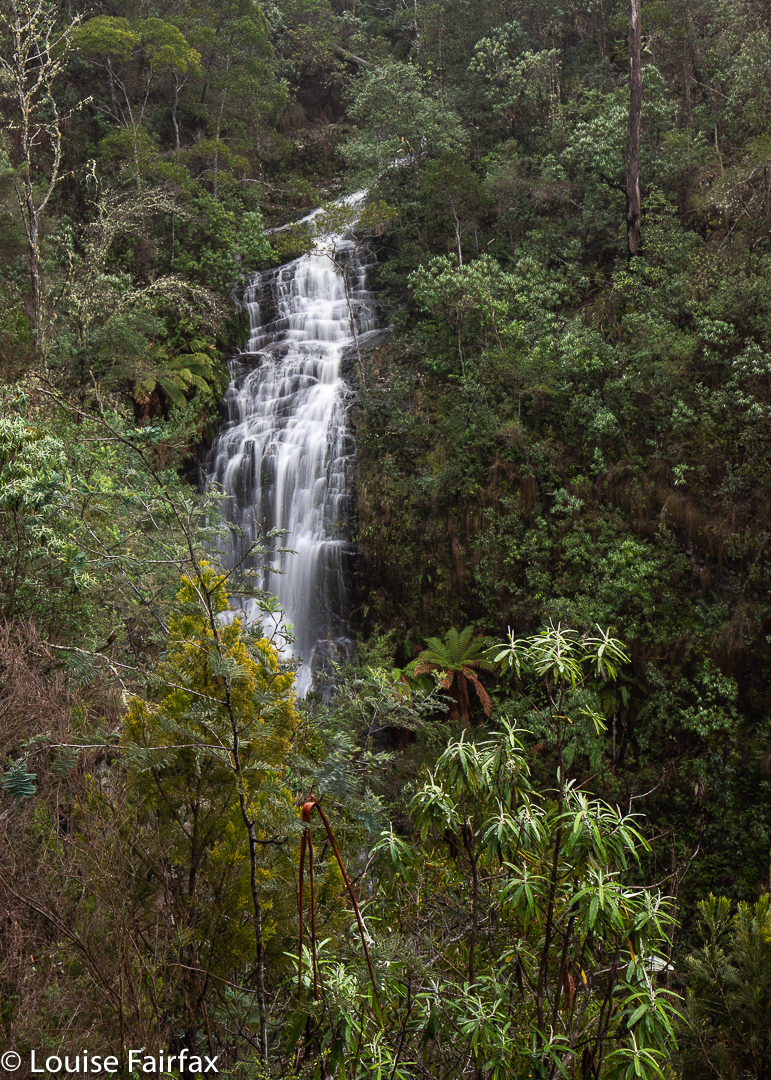
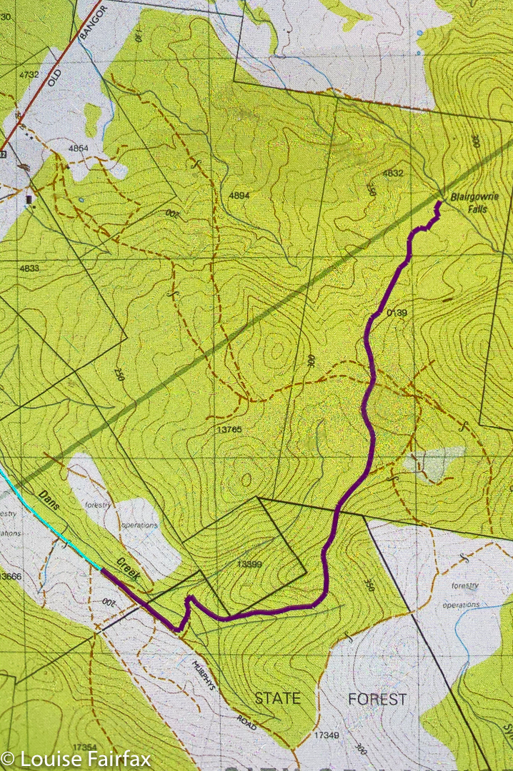
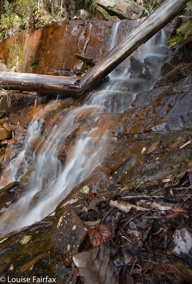
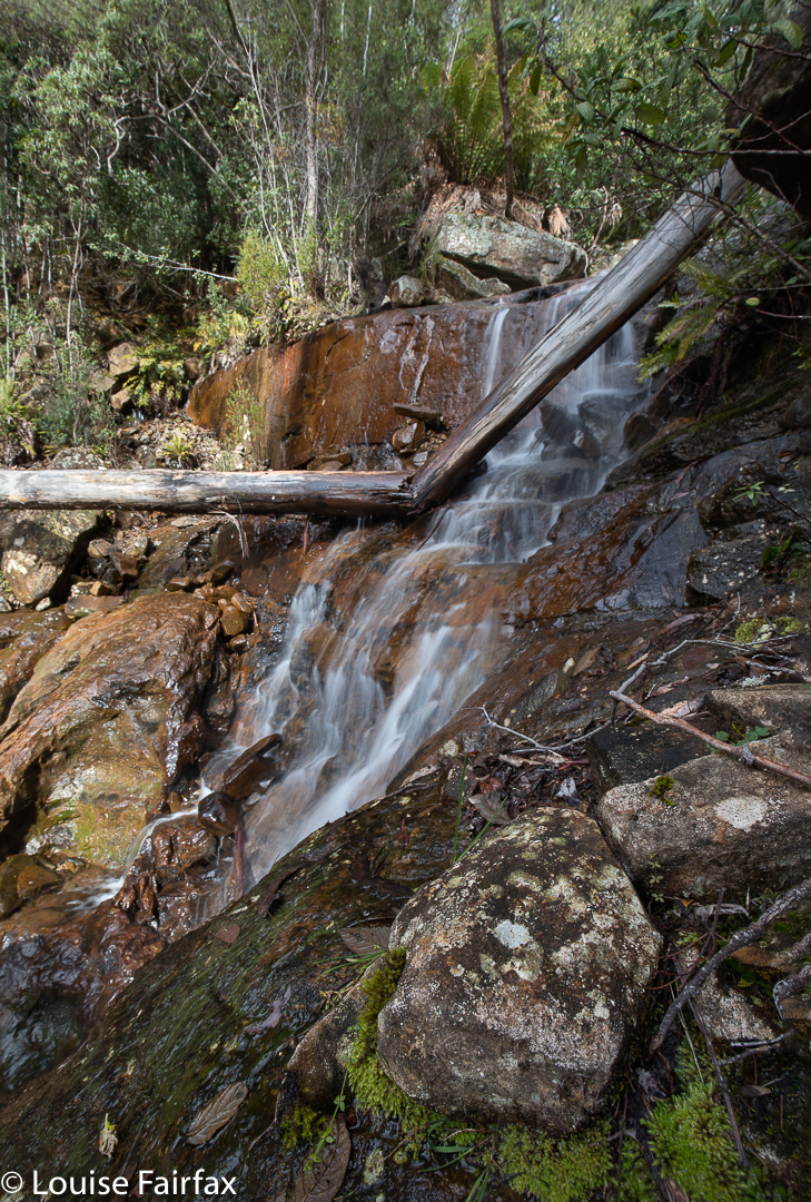
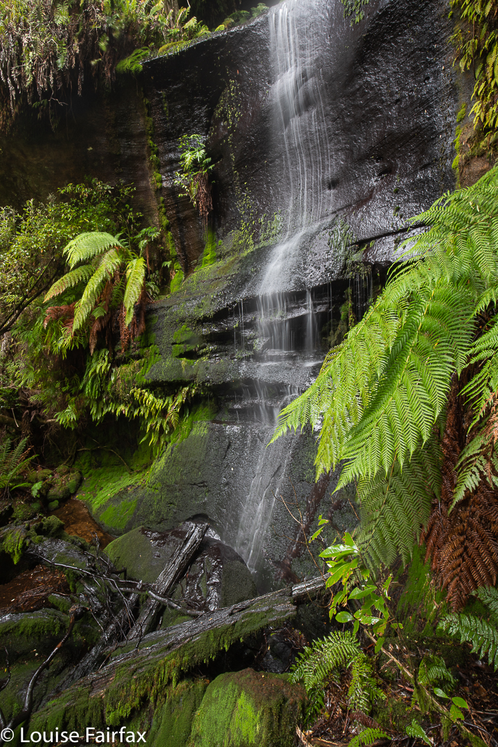
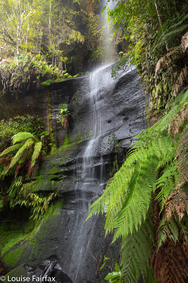
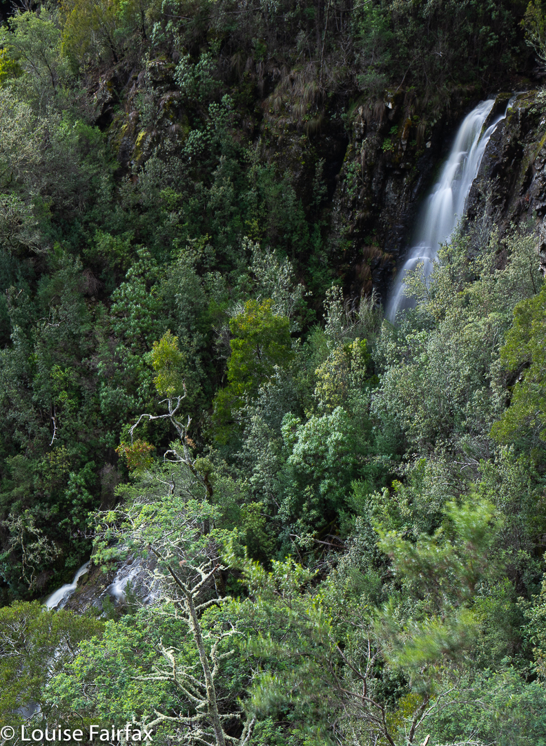
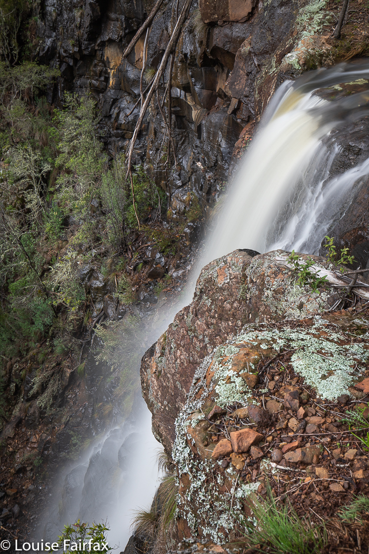
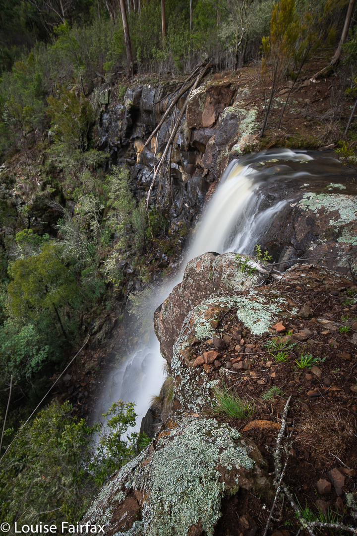
When map staring around the St Marys region, my eyes found two interesting little blue lines that needed exploring: one had a name, viz. Webber Falls; the other was on a tributary nearby, and was south of the named ones, so calling it Webber Falls South seemed appropriate. The “featured image” at the start of this article is a front-on shot of the actual Webber Falls, with three tiers. As you can see, the river kind of curls between tiers, so you need to be high to get all three in a shot.

Webber Falls from the side

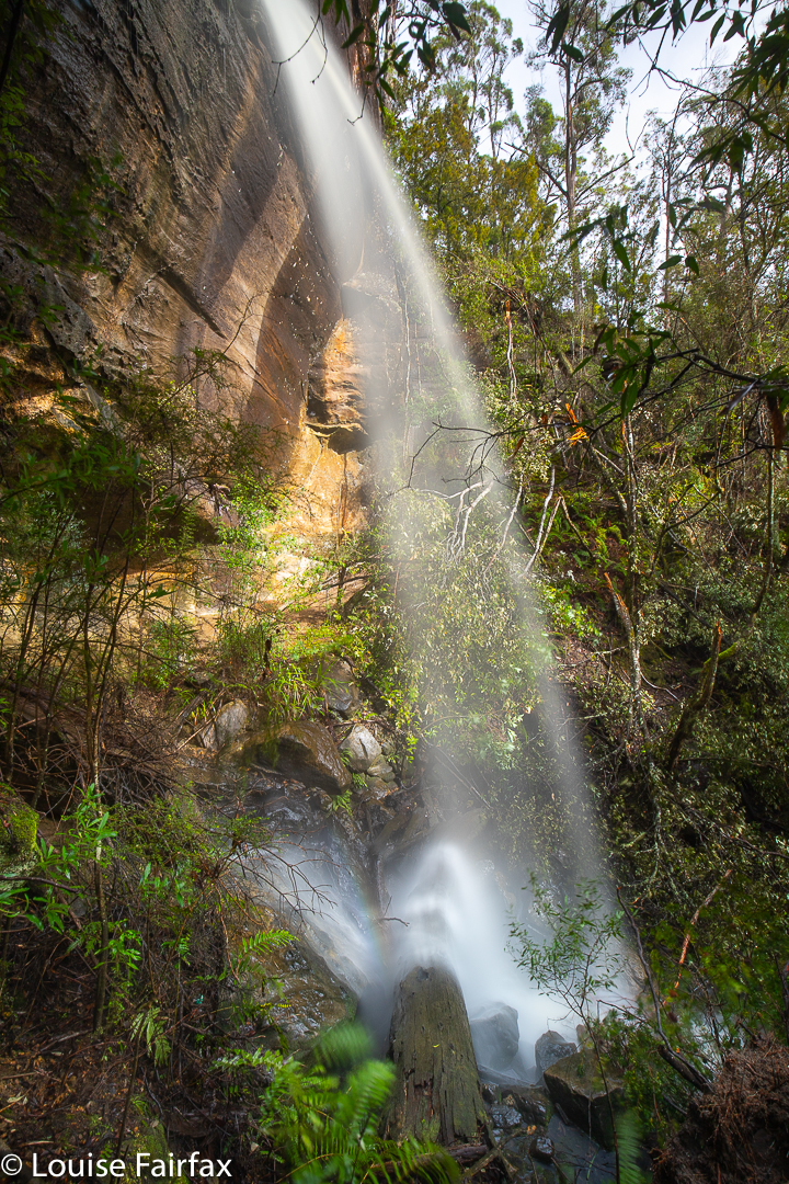
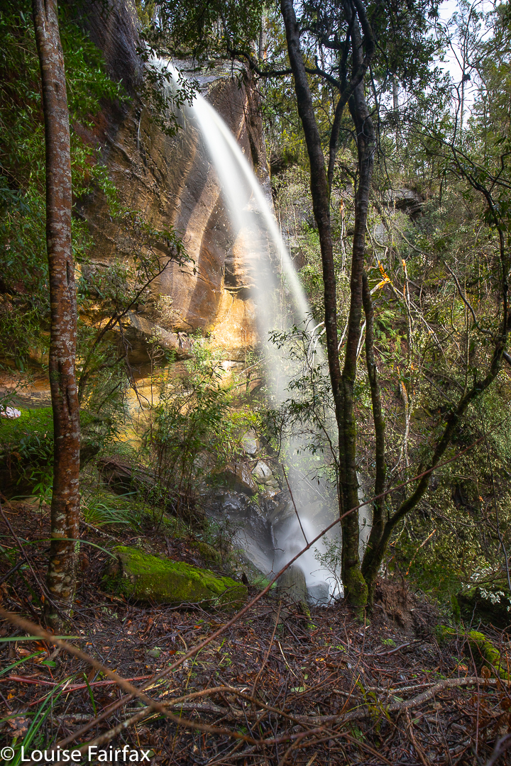
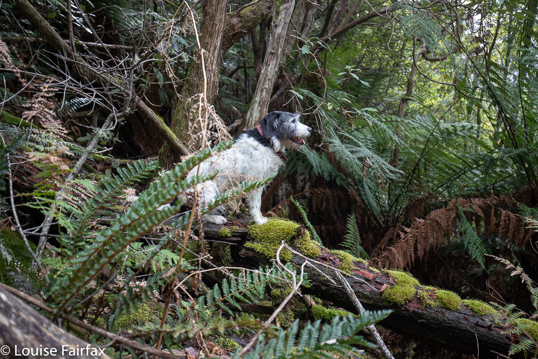
I had heard they were extremely difficult to reach (my friends failing to do so), so set out without a great deal of confidence. I can now ascertain that the saplings that hug the creek area are very close to each other, which is easily overcome if you have my stature. Maybe it put my other, less-skinny friends off. I can also confirm that the ground is VERY steep, but, worse than that, it is unstable. I can count on one hand the number of times I have sent a rock flying, but these soccerball-sized rocks were in soil that was not well-glued, and it gave way very easily. The drops were humungous. I was a nervous wreck by the time I got to my chosen position for photographing the southern falls (having come via the actual falls). You couldn’t assume that the ground would stay put if you trod on it. I didn’t even put any trust in living trees, which are normally pretty reliable.

Webber Falls South

As if to prove my point, while I was slightly altering my camera’s orientation, my filter holder detached itself from its ring and dived overboard. I never heard it land. It had within its grasp my beloved CPL, as well as my much-used Little Stopper. So little did I trust the terra non firma on which I was crouched that I didn’t even dare lean out to see if it had found a shelf. I sort of tried around the side, but even if I had just had the displeasure of watching $1000 do a fancy dive, my life is worth more than that, so I sobbed at the extravagantly expensive but very brief show, but called it quits.

Webber Falls South. Bye bye gear.

I was not in a good mood driving home. Not only had I wasted a huge amount of money, but I was also now without my playtoys until new reinforcements can arrive. Waterfalls are flowing, and I don’t have what I need to make best use of it. But, hey, this is the person whose husband died in the wilderness. I am alive; my other family members are safe at home; my dog is alive. Much worse things can happen than watching your equipment dive over a cliff. Life and relationships are worth more than money or toys.

Grey Mares Tail Falls 2020

How does a waterfall get the odd name “Grey Mares Tail Falls”? Especially one that is in wet sclerophyll forest in the middle of the steep slopes dropping to the East Coast of Tasmania after the giddy heights further west. I wouldn’t have thought there’d be too many grey mares above or below the falls to prompt a connection. However, there is a Grey Mare’s Falls in Scotland, (with perhaps even some grey mares floating around nearby), so I can only assume one terribly homesick Scot named the falls after his former abode.
One doesn’t see this waterfall in flow very often, so it is also difficult for most people to assess the extent to which it does or doesn’t remind one of any horse’s tail, let alone that of a grey mare. And why does the horse need to be female??
Anyway, if it has been raining quite a lot, and you are in luck, and happen to be driving from St Marys to the coast (or back), then at the very top of the pass on the northern side of the road  is a little reserve with a parking area and a finely made trail taking you to the falls. This trail is quite pleasant, albeit it very short, so even if there is no water falling, it is a good place to stretch your legs if you didn’t do so in St Marys. And if you missed the water, and are curious about what the falls look like, here is a photo to satisfy your curiosity. I do not recommend travelling a great distance solely for the purpose of photographing these falls. This is the first time I have ever seen them flowing! I popped in as I was in the area to photograph the nearby two Webber Falls. It was raining, so I thought I might as well try my luck, and after a day filled with anything but good fortune, I did at least strike some here.

Please excuse the lack of apostrophe, educated people, but in deference to those who can’t cope with correct grammar, Aussie place names no longer have them. The English do, although Brexit belies any assumption that this is based on superior education in the former Mother Country.

Blairgowrie Falls 2020 Aug

Somehow my route for Blairgowrie Falls was deleted from both my 2017 blog and also my gps. I have no idea how this happened, but several people have asked me about my route, and I didn’t like the 2017 photos, so it was time for a revisit. The forecast was a promising rain then clouds then more rain, but not heavy. Off I set to undo the deletion damage.
I drove from Launceston to near Hillwood, then headed off to the right (Dalrymple Rd C809 ) to Old Bangor Tram Rd C812, from which the road I wanted, Murphys Rd, issued. Siri can get you this far.

Blairgowrie Falls

I turned into Murphys with confidence, my gps now turned on, ready to repeat my route of 2017, BUT there hadn’t been a huge snow storm in 2017. Murphys Rd was more like a series of swimming pools of unknown (and invisible) depth than a thoroughfare for motorised vehicles. I was VERY glad to have my AWD, that’s for sure. And then the fallen trees began. There was absolutely no way any kind of vehicle could drive on Murphys Rd in its current state. But that’s what legs are made for. I parked and got to walk for longer. I wanted exercise, and the forest was pleasant enough, even though it was too late for fungi and too early for spring flowers (although I did see a few of both).
The fallen trees, however, made the going very slow indeed, especially for the first kilometre. My whole time was spent bushbashing along the cluttered road: ducking and weaving, climbing and tunnelling. I had absolutely no assurance I would manage to get anywhere near my goal, and was also not certain that it wouldn’t just be a rubbish dump of branches and debris like the road leading to it … but, nothing ventured, nothing gained, so on I moiled through the fallen junk. Tessa hurdled all the trees with astonishing grace. She floats like a kangaroo. She also ducked under fallen objects with far more ease than her taller mum.

Blairgowrie Falls

The falls were well worth the effort, and I enjoyed the amount of exercise I got, which gave me an excellent drive to walk ratio. I took 58 minutes from the car to the top of the falls, and 55 minutes back. My only complaint about the day is that I began and ended in light rain, but the wretched sun came out while I was at the falls, marring my photos. Ah well …

Blairgowrie Falls route. Cyan is whilst driving. The magenta is the section I walked, roughly 4 kms in each direction.

Dare Falls 2020 Aug

As I approached my waterfall (from above, actually), I gazed out at the facing ridge of what appeared to be loosely assembled scree that rose (or fell, if you will) in a sharp incline between the forest floor and the points of Ritters Crag above. I was reminded of a similar slope I had descended to reach Bear Falls on Mt Wellington, and with Bear Falls in mind, and my own rather foolhardy daring in being where I was on a solo battle with scrub and cliffs, I named my waterfall Dare Falls. It rhymed, and was appropriate. I had scaled nearly 400 vertical metres in a horizontal distance of not much more than a kilometre of untracked, and at times thick, bush. Surely not many people would dare that absurdity. (See the altitude graph below).

Dare Falls Lower

I had not set out to be daring. I have, unfortunately, little respect for contours, and enjoy the act of climbing, and of pulling myself up slopes. It’s my idea of fun. The excursion only became “daring” in my mind when the beautiful rainforest ceded to thick bush that resisted my attempts at progress, and became mentally tiring to push through. I had intended to begin my exploration of this watercourse higher up than I did, but the sight of all that interwoven scrub (taller than I was) made me reconsider. I reminded myself that I was here for FUN, not punishment, and not to prove anything to anyone, so decided that my outward journey had finished. I would descend to the creek and work my way down it.

Panellus longinquus. A pleasant interlude in an adrenalin-filled day.
My darling bush buddy, waiting patiently. The bush we are about to traverse is off there behind her.

My climb up had been more on the dull nose of a mini sub-spur and, although it was very steep – all fours territory – there were no big cliffs to avoid. Closer to the creek this was not the case, and the watercourse seemed host to a series of 4-5 metre cliffs which I had to skirt as I lowered myself down. These same cliffs meant the existence of many small falls, but you can’t photograph everything, and I just wanted to make sure I actually got out and safely. In fact, I was actually more concerned about the idea of being enmeshed in closely serried dogwoods than falling off anything, but I was concentrating on movement and not photography.

Hydnum repandum with its funny spikes instead of gills.
Hygrocybes brighten any day

Down, down I dropped, past Dare Falls and Lower Dare Falls (how very original) to the endless series of drops mentioned above. I lacked the emotional energy to explore any of them by this stage. My brain was now officially tired. It was so fatigued I hardly photographed anything properly. The whole idea of perching precariously on one of my many ledges and parking my heavy rucksack in a way that would allow me to extract my tripod seemed impossible. Something would be overbalanced in the attempt. My gear (or I) would crash down below. Much better to use rocks as makeshift tripods. I didn’t even get out the filters I was carrying. I just used a series of 20 x 1/10 second exposures to combine for a single long exposure later. Even lower, where it became safer, I was just too mentally tired to be bothered – even in the presence of fungi!!

Lycoperdon perlatum

My final obstacle before the easy bit along the bottom was the same as my original one: a crossing of the Duncanson Rivulet. I hauled out anything electronic and made sure it was all in a drysac, grabbed a stick to help with balance and picked my way across the slippery rocks with water flowing over and between, singing as I went an old Seekers song (which dates back to a Scottish folksong of the 1600s): “The Water is Wide, I can’t cross o’er”.

Altitude graph

Warners Creek Tributary Falls

When we were walking Warners Track last week, I noticed a tantalising blue line across a neighbouring creek, and wanted to do a bushbash to see if that line actually represented a real waterfall, and, if yes, whether that waterfall  was a worthy one. The contours certainly looked promising. In fact, it could be a huge drop, looking at the map. My friend Penny said she was also interested in this matter, so we agreed to give it a go this weekend.
We parked in the same spot as the week before, but went off in a different direction, up a pretty steep slope, over and under and through numerous fallen logs, around the odd patches of rather thick dogwood and regrowth of some nature, past serried tree ferns, and there was our promising cliff line.

Warners Creek Tributary Falls

My gps said we were closing in on our grail, and sure enough, it soon became visible. We haven’t had much rain lately, so it was a delicate drop today – a fine and flimsy tracery of water, dropping about thirty metres in three close stages.
It’s always very rewarding to find a waterfall that is only a possibility rather than a certainty, and to make our own unaided way there through virgin bush. How lucky we are to live in a place where this is still possible.
We chose to have a slightly different route on the rebound, exploring other areas of forest, to make a kind of circle by the time we arrived back at the car. It always feels good to have been off exploring. I knew I had missed it during lockdown, but today I realised how very much I had. Warners Track had been very nice, but making our own way through unchartered forest is far, far better.