Aldebaran 2018 Apr

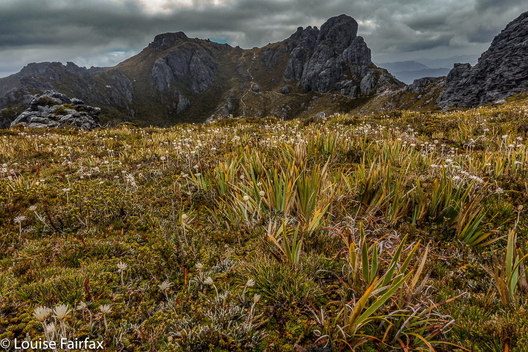
Mt Aldebaran, Apr 2018


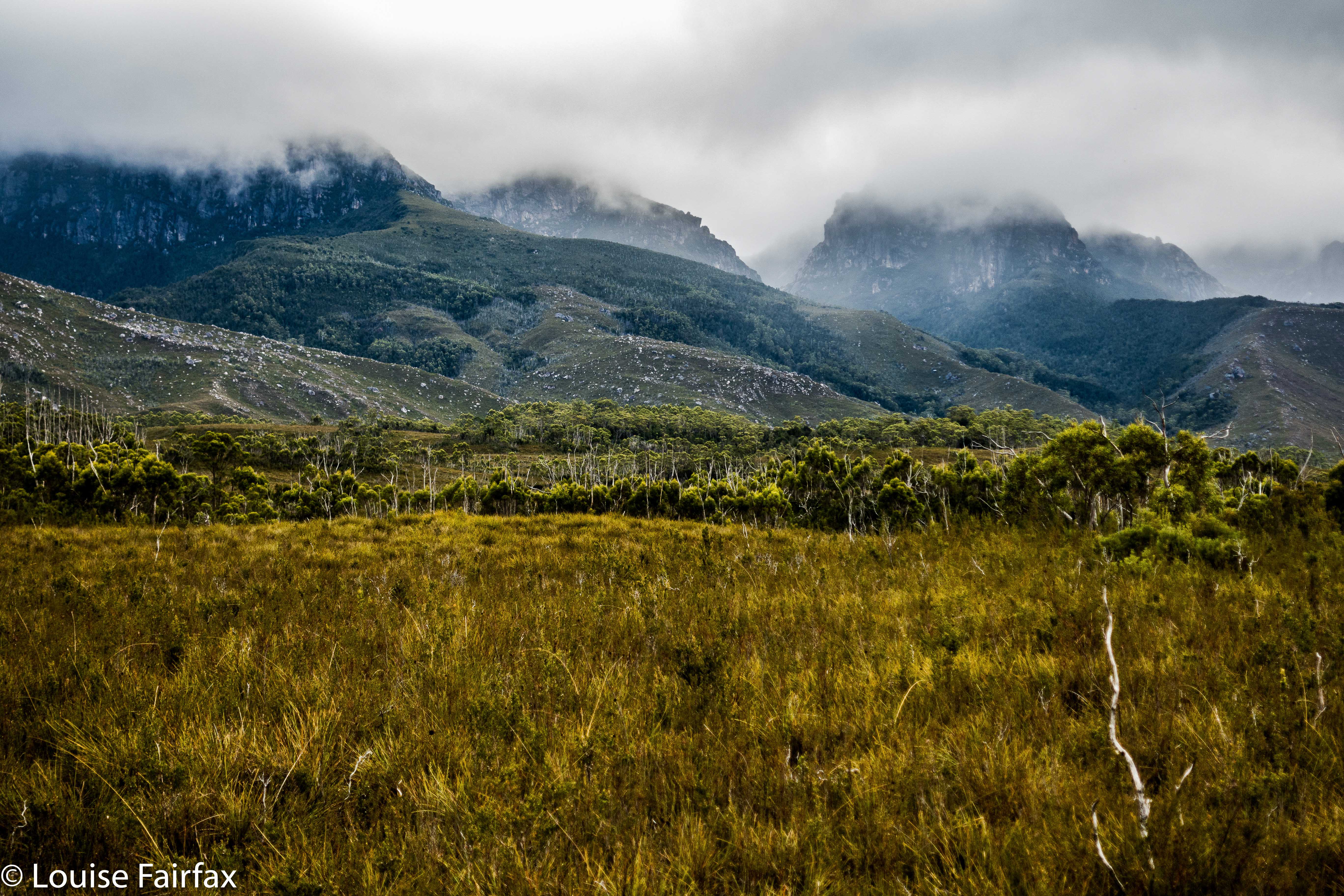
Somewhere up there Mt Aldebaran is hiding. Looks inviting, huh?
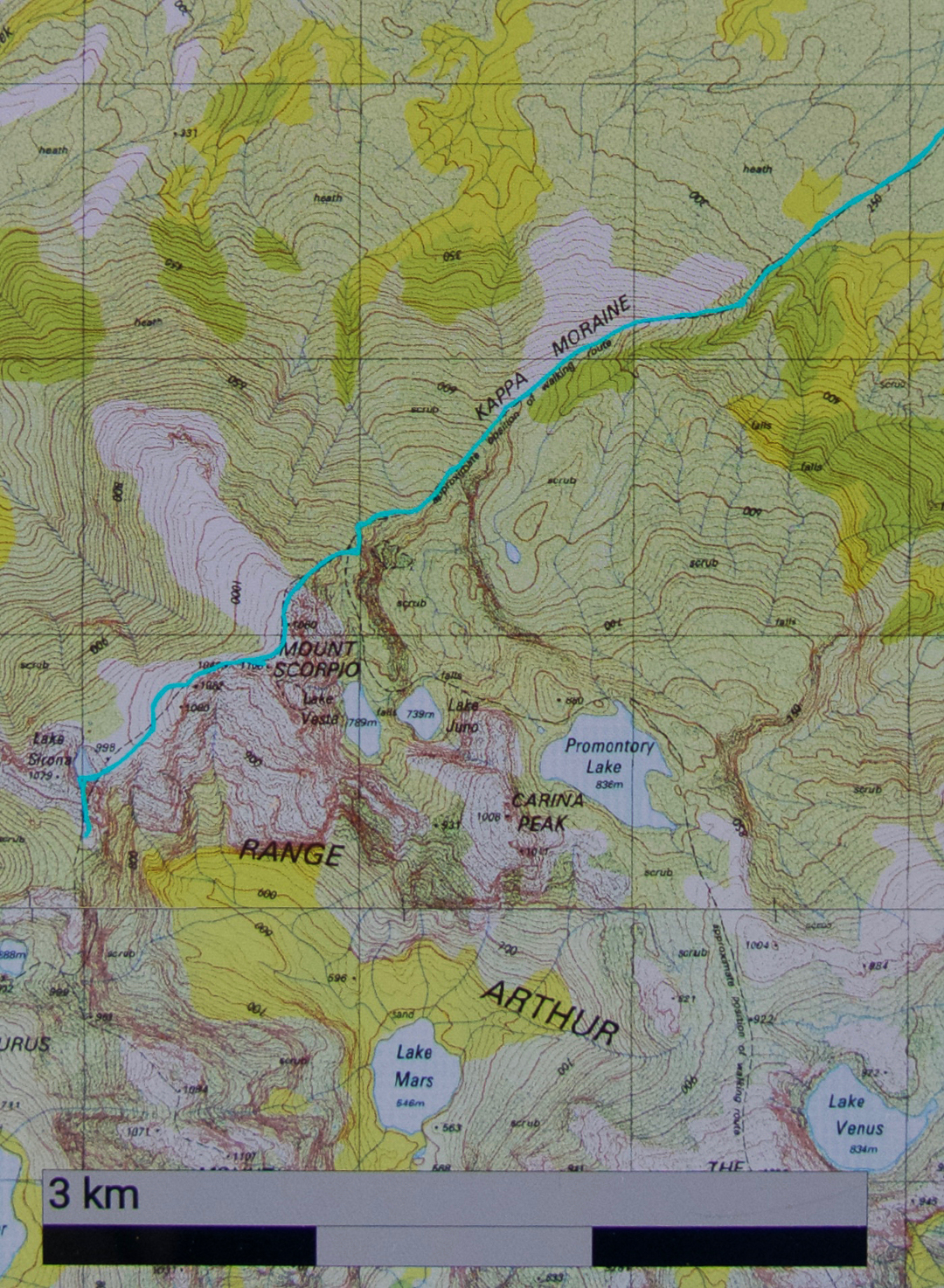
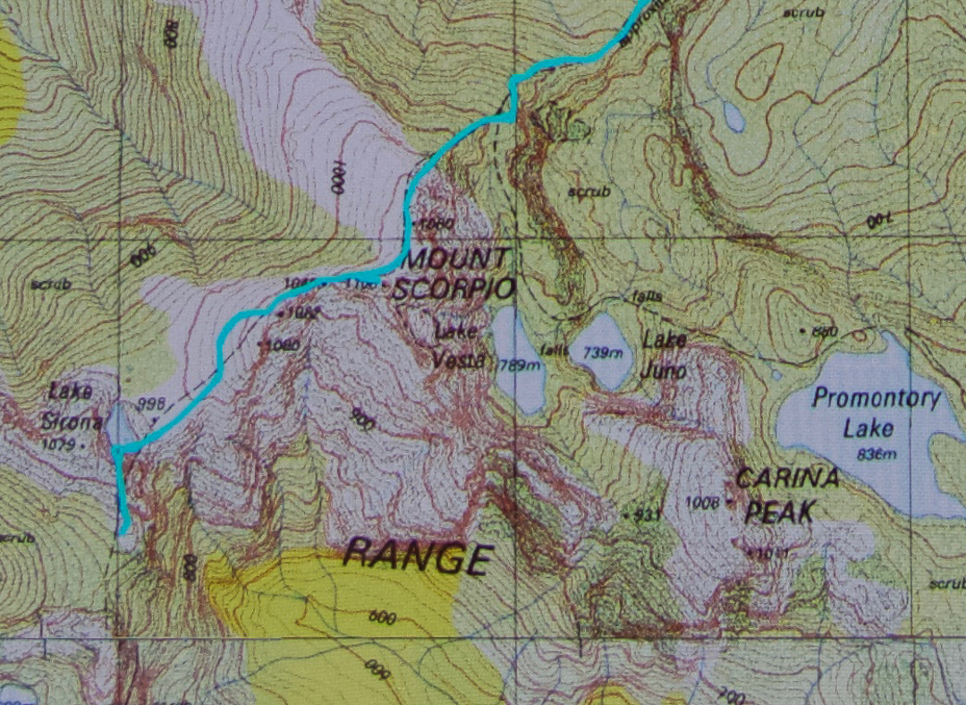
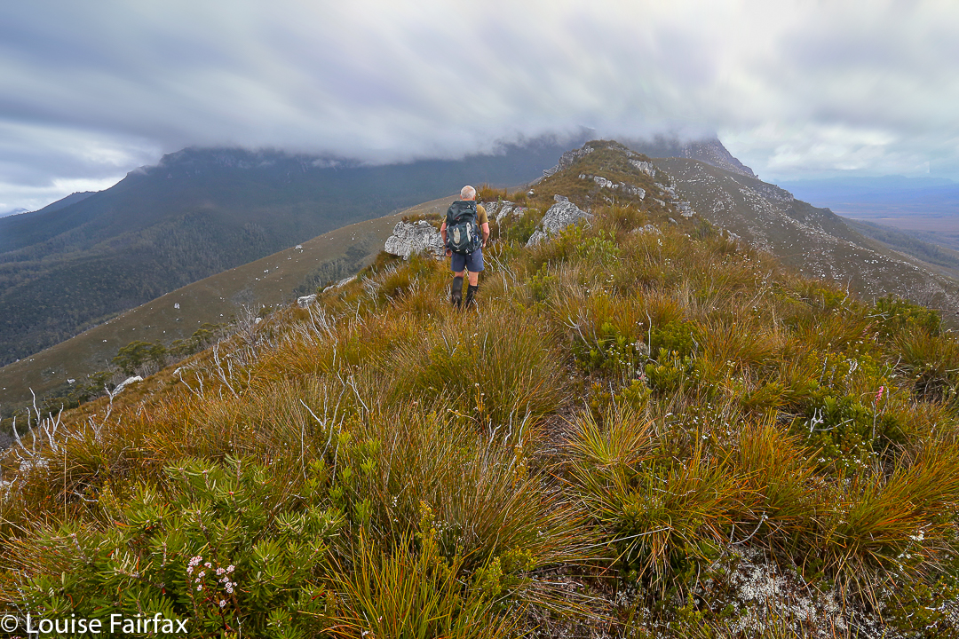
I really wanted to climb Mt Aldebaran before the super cold set in, having missed my chance over the summer. I decided it needed to be a solo venture, but thought I’d like to do it in the school holidays, as maybe I’d accidentally meet someone up on the range, and that would feel nicer. I had my plan: early start on day one, use the Kappa moraine shortcut and continue up to Lake Sirona to sleep. I’d looked at my stats for what I’d done in the area before, and this seemed feasible. Day 2 would be a shorter, easier day, just climbing Aldebaran from Sirona and enjoying being high for what was left of the day. Day 3, I would begin my descent and climb Carina Peak, dropping just as far as Promontory Lake. Day 4, out. But then I got an email from a friend saying he’d like to join in. He lives in Hobart, so starting Thursday morning suited him (rather than sleeping in the carpark Wednesday night, as I had envisaged). That was fine, although it did make reaching Sirona unlikely, but having his company – a mud buddy – would be lovely, so I agreed.

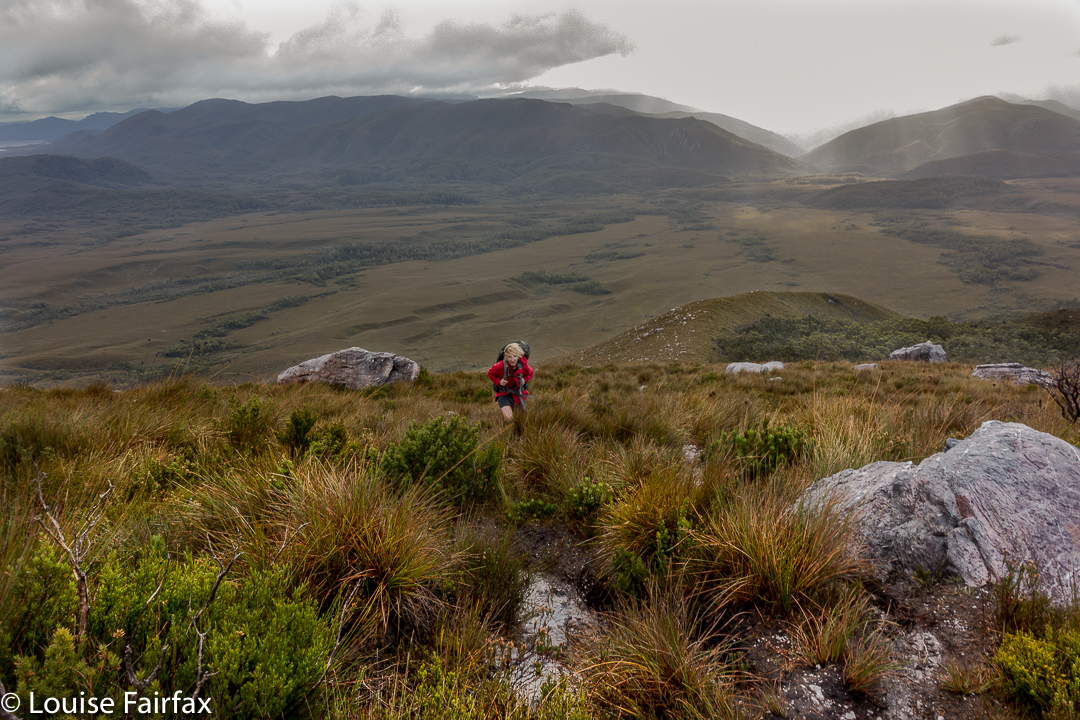
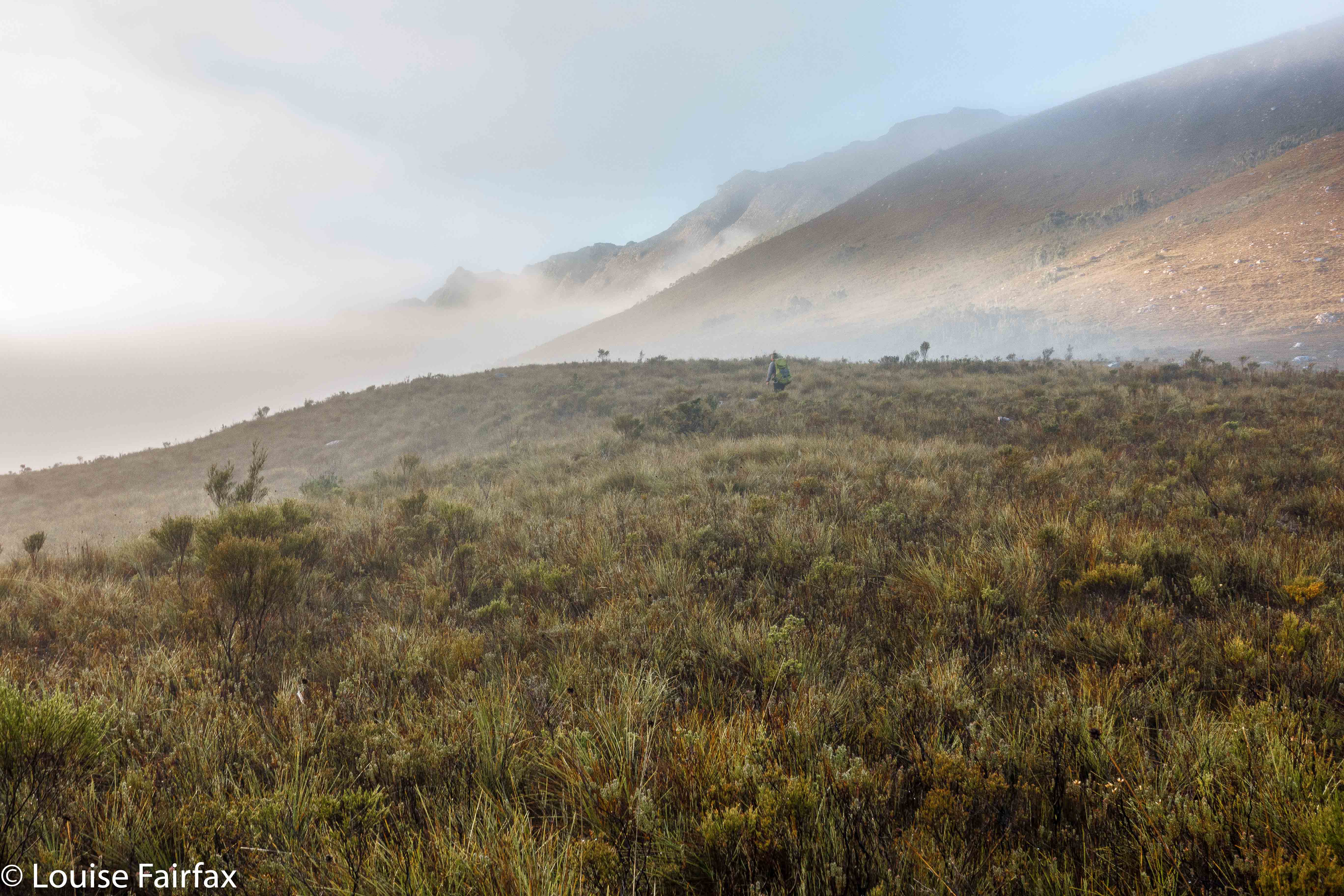
If you look carefully you can find my friend heading off into the mist.
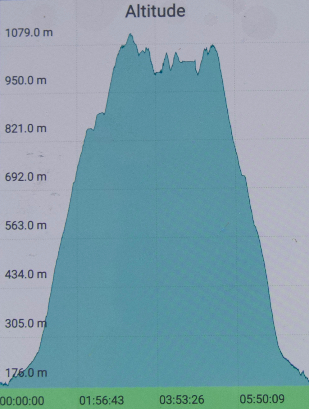
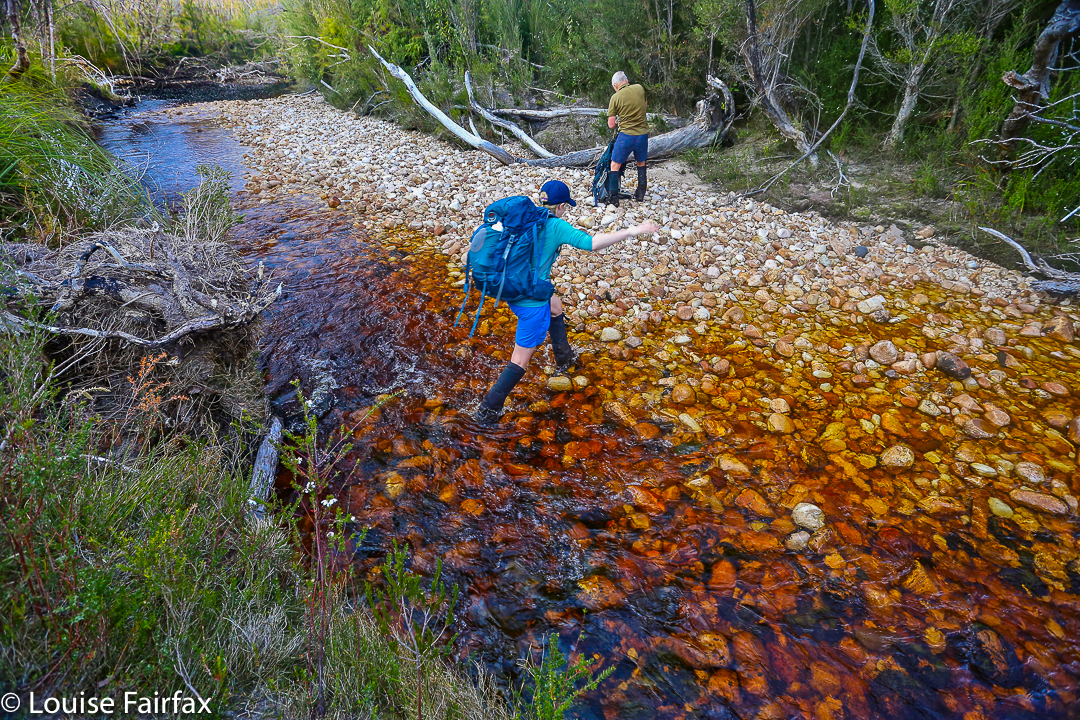
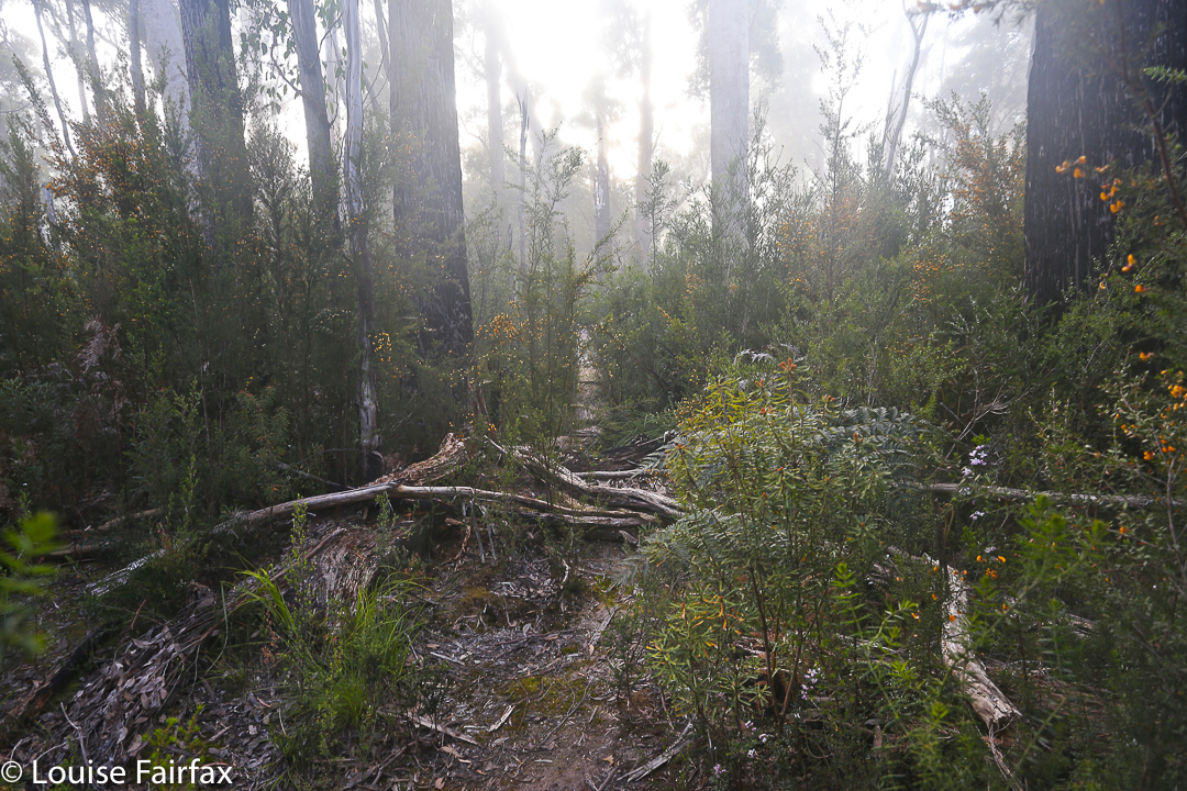
Day 1 did not go brilliantly. Our later start ended up very late indeed, and the track was very muddy and slow, We only made it to just past Seven Mile Creek before dark set in. I squandered half and hour at the tail end of the day trying to find a suitable crossing point for the creek that had now reached fast-river proportions. I kept going upstream until I found a fallen tree that I could hold on to. I didn’t trust myself not to be swept away otherwise. And now it was dark. Time to pitch the tents, collect water, eat and sleep. Boom. No mucking around at this end of the day. I reckon my eyes were closed by 8 pm, having got up at 4.30 to drive down to Hobart.

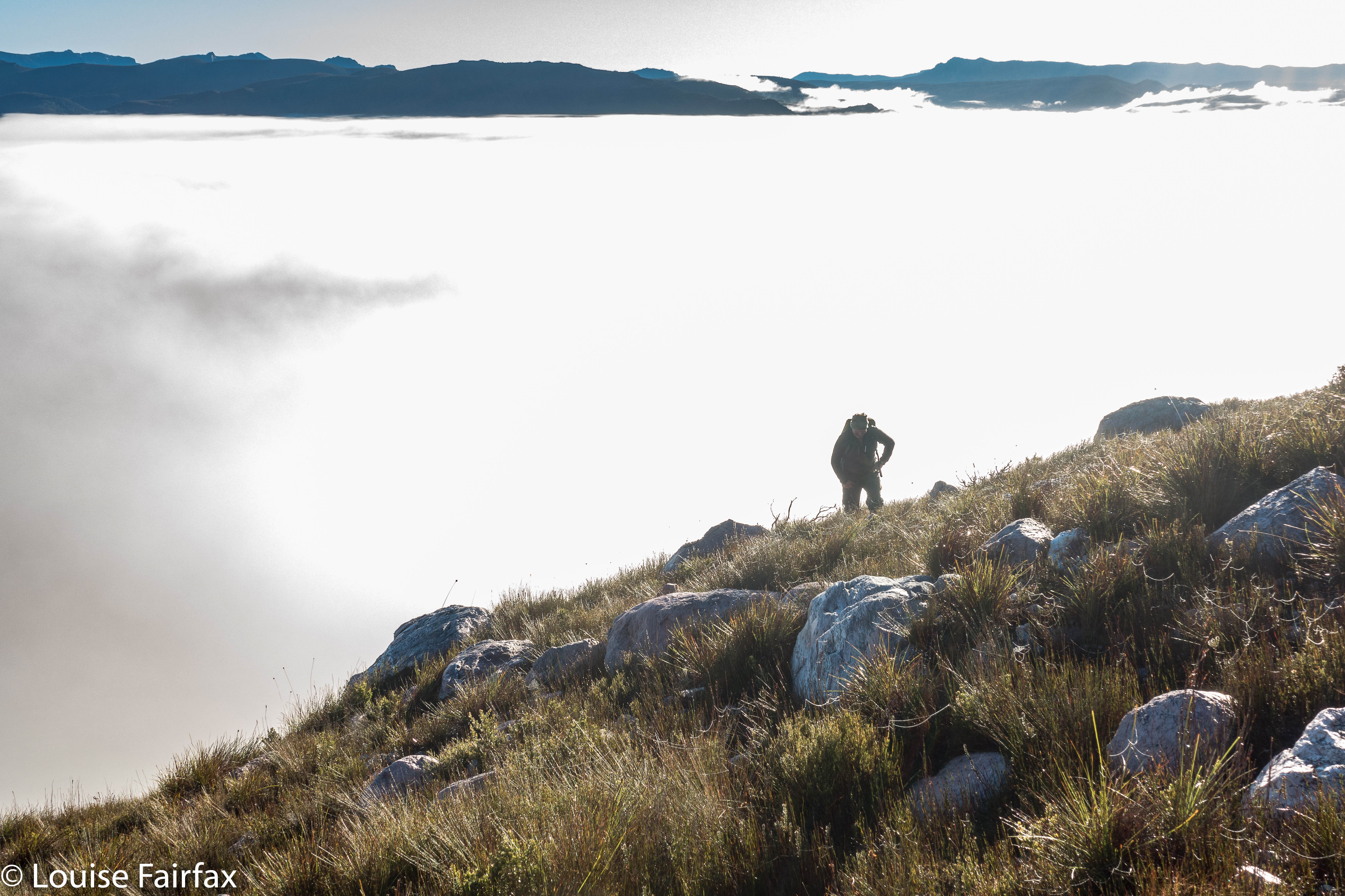
Up above the clouds already.
All night, it seemed, I pondered the dilemma of what to do with our shortened camping spot. My friend had struggled in the afternoon, and I thought getting his tent up the steep climb could take so long that we would be timetabled out of climbing Aldebaran, which would mean we had to do it on day 3, making day 4 too long. But, leaving the tents where they were and climbing up and down in a day was risky, as it would be a long day, and if we failed, then the trip failed, as there would not be enough time to then get the tents higher and start again. In the end, and with huge reservations, I decided to risk a long packless day, thinking that that would give the best chance of a summit.
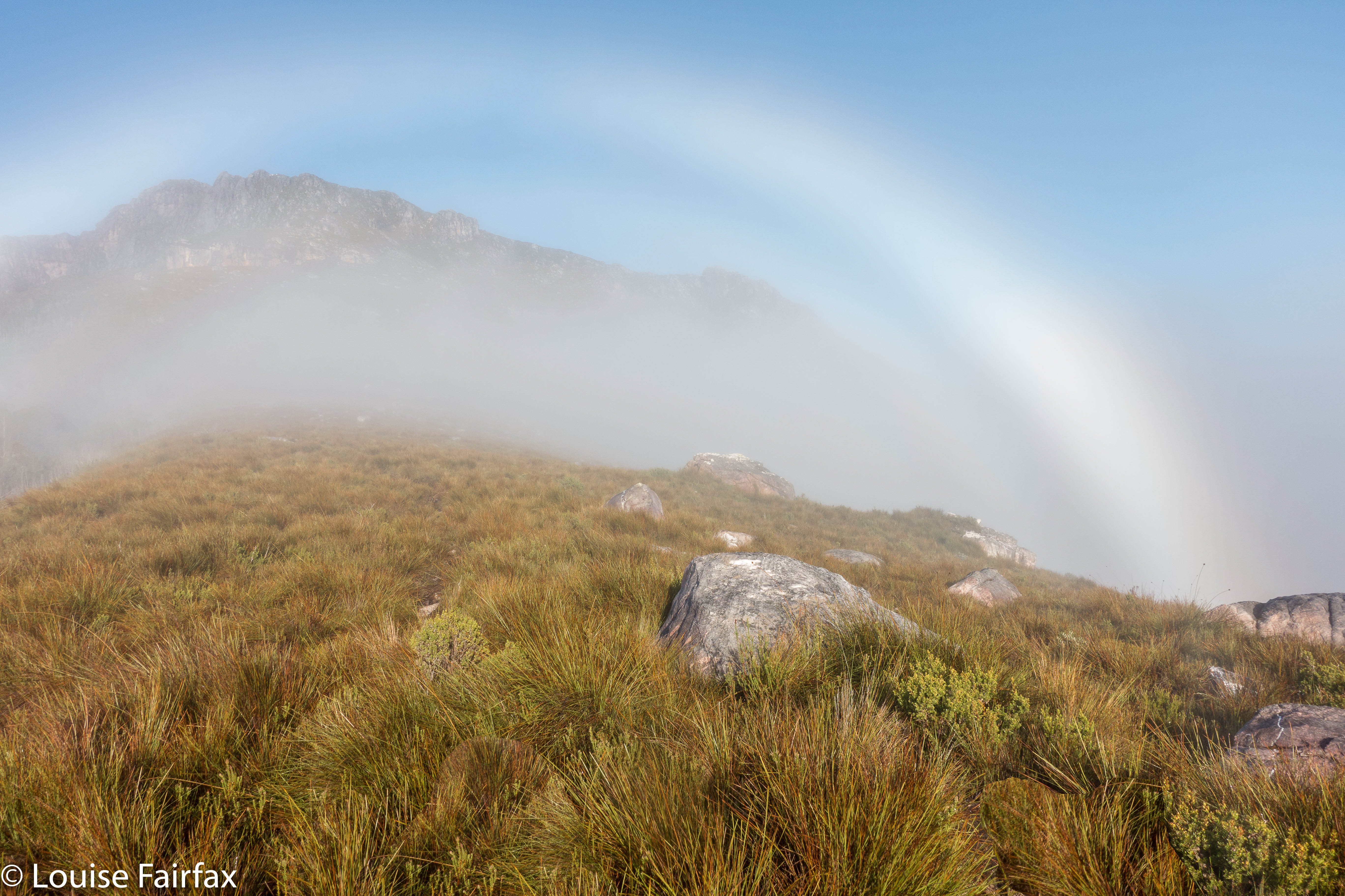

A fog bow
Off we set at 7 a.m. Unfortunately, once we started on the steep section, our differences in speed became very noticeable. It was too early in the day to worry. At 9 a.m., my friend suggested I go on without him; he was not having a good day. I said I thought the worst of the climb was over, so let’s stay together longer, but at 10.40 a.m., I had to admit defeat. If we didn’t separate, I wouldn’t get my mountain, so, during the climb up out of Lake Sirona, we parted company, agreeing that I would catch him somewhere on my rebound. I hoped that’d work out.

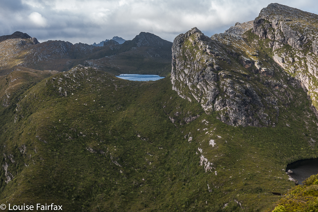
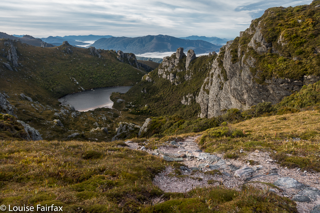
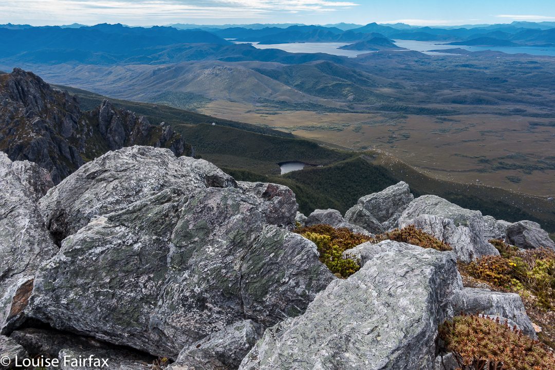
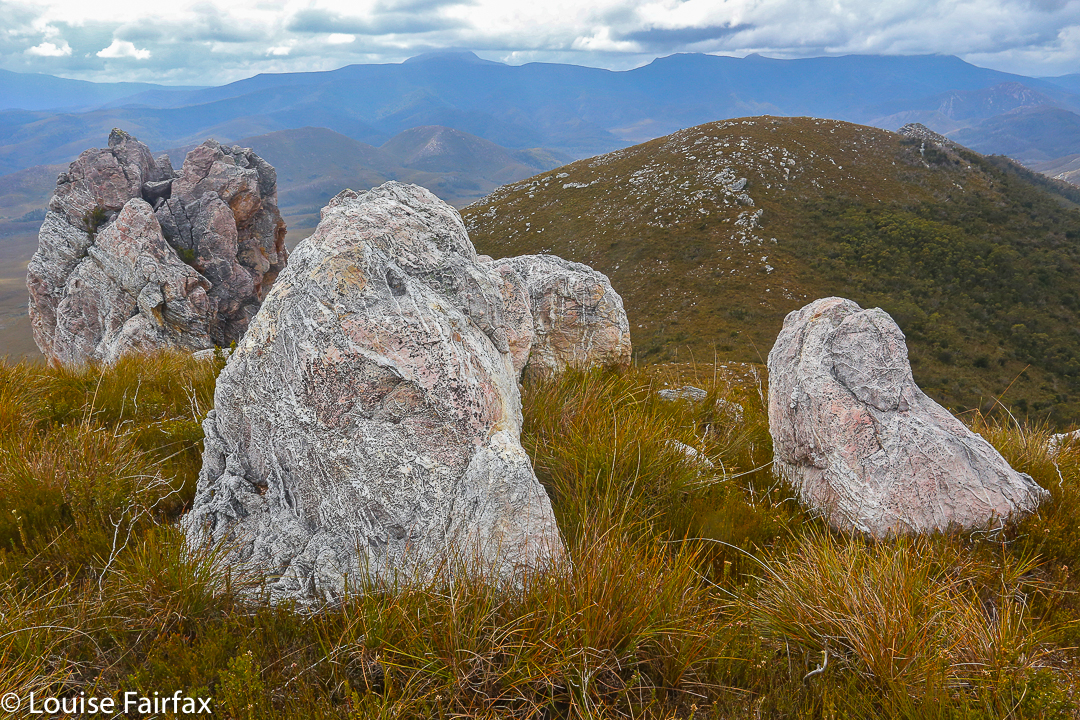
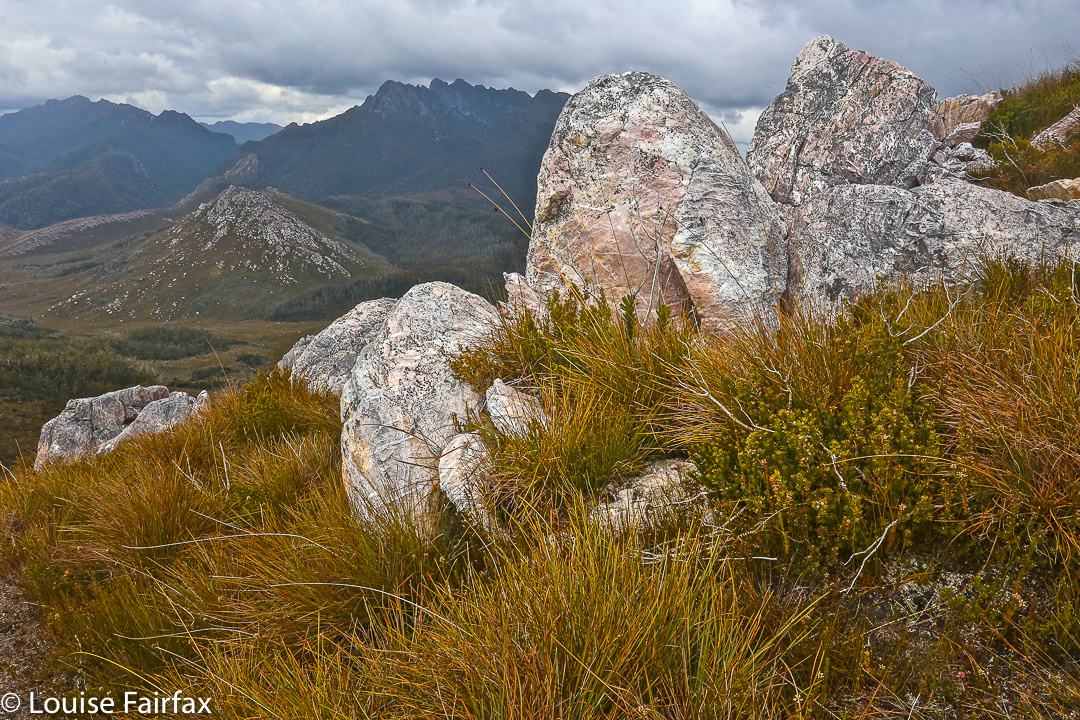
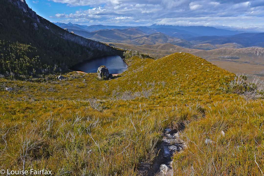
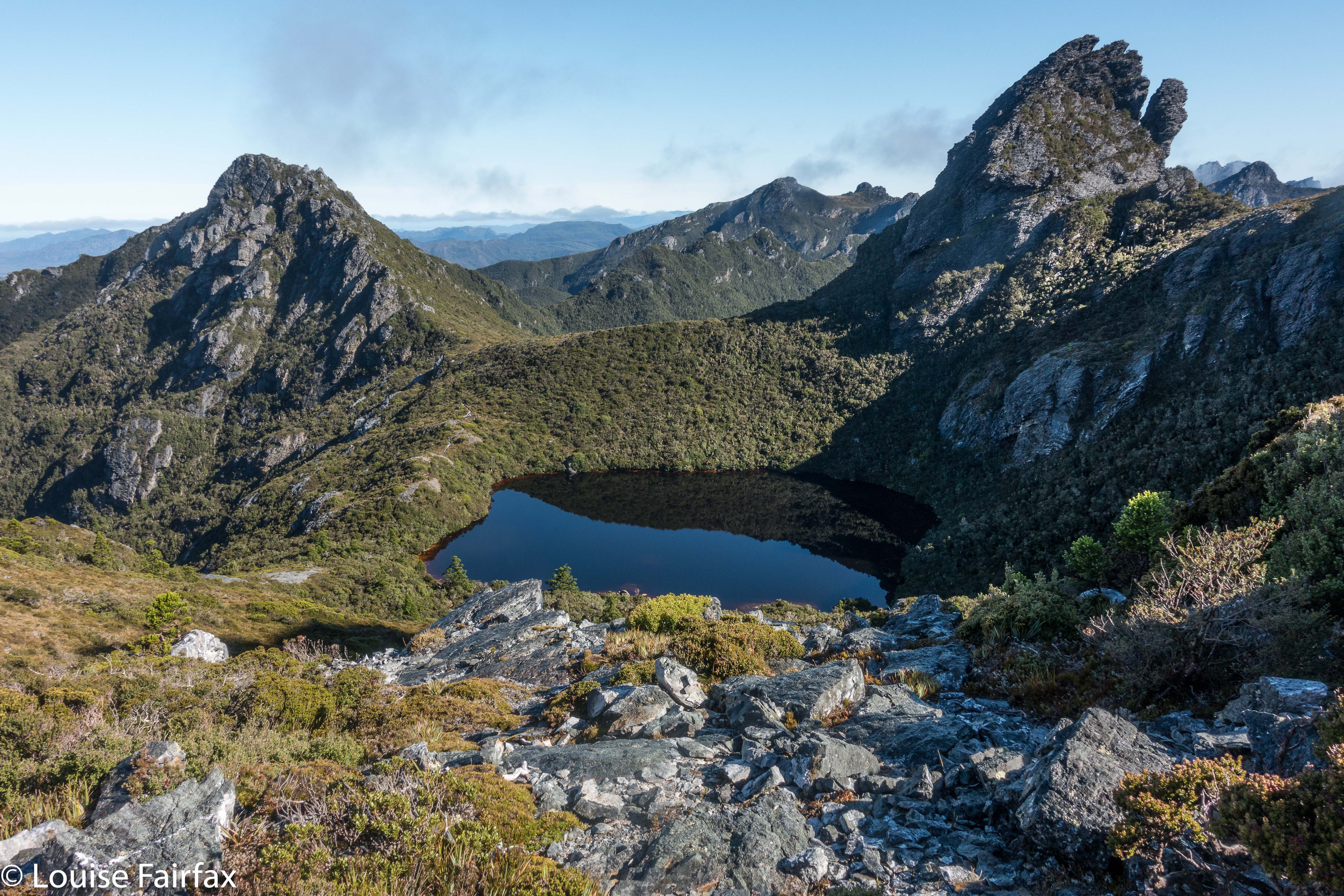
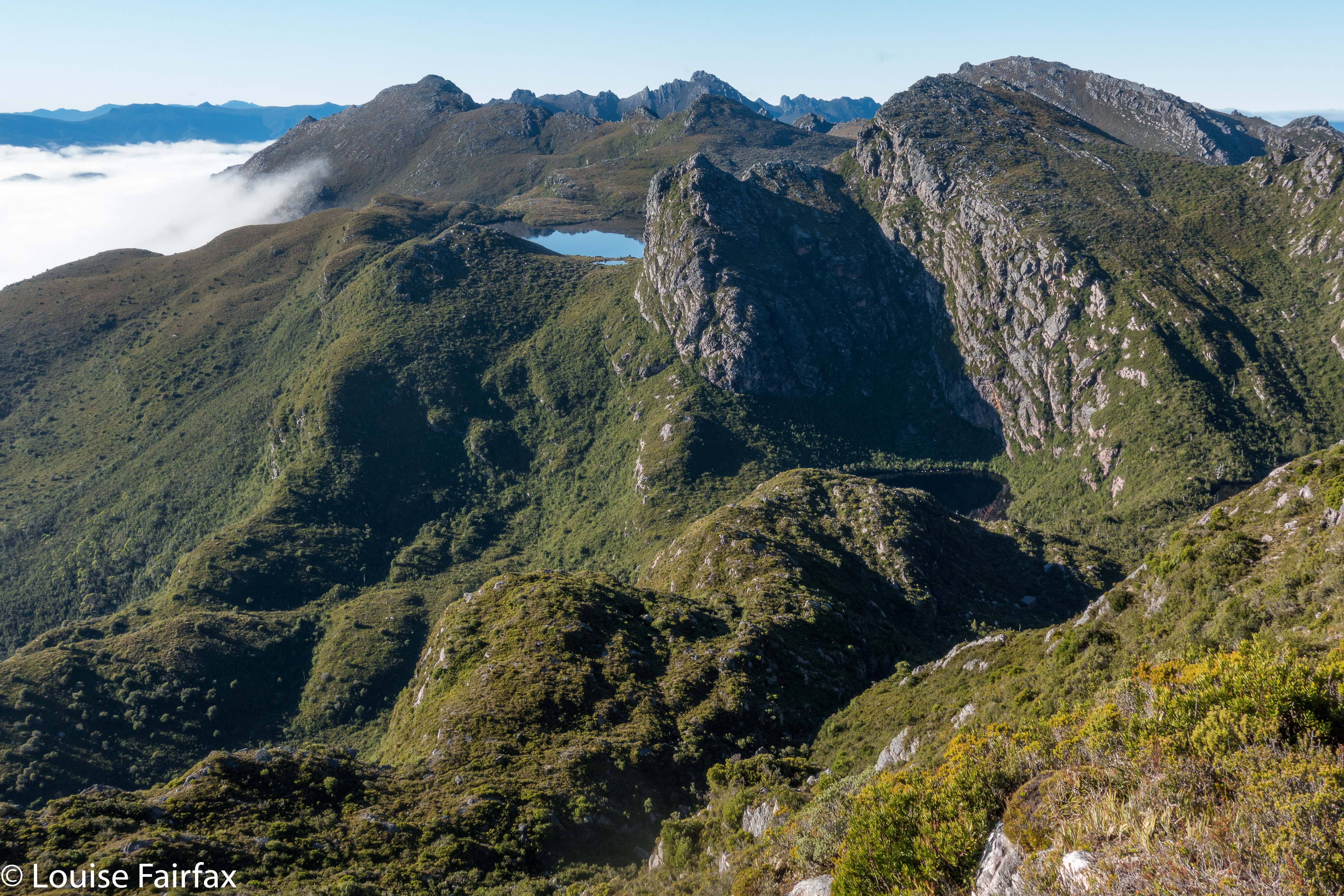
From on Kappa moraine, looking towards Lake Promontory.
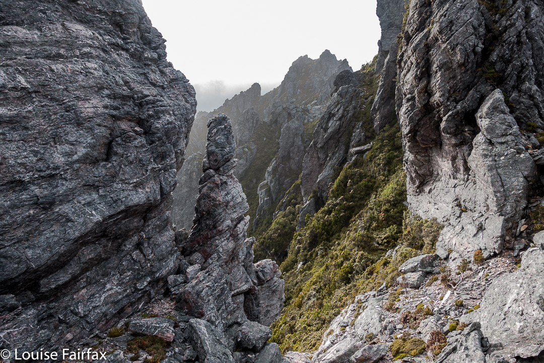
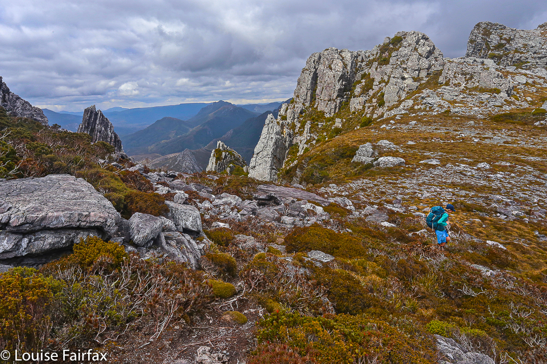
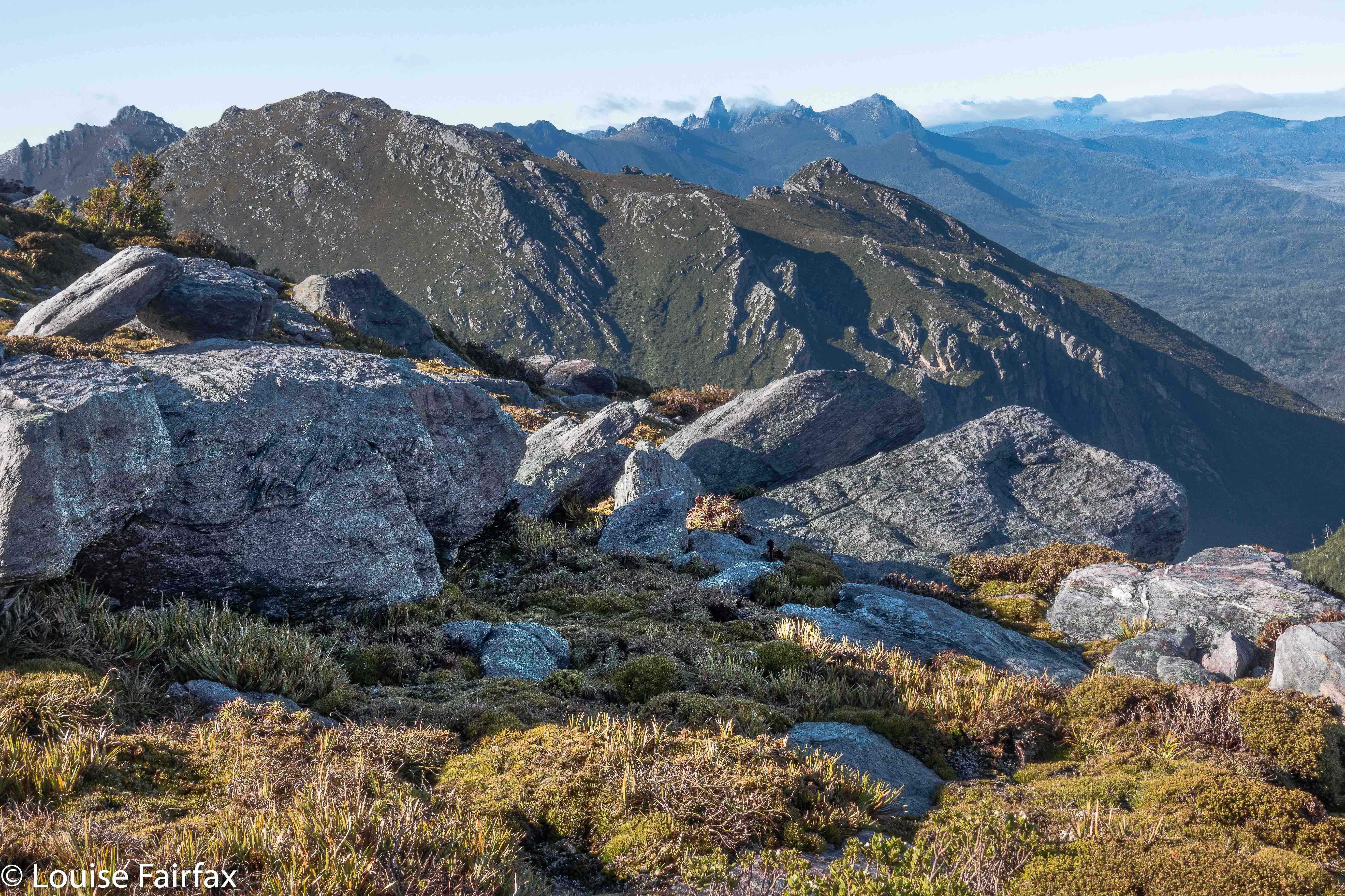
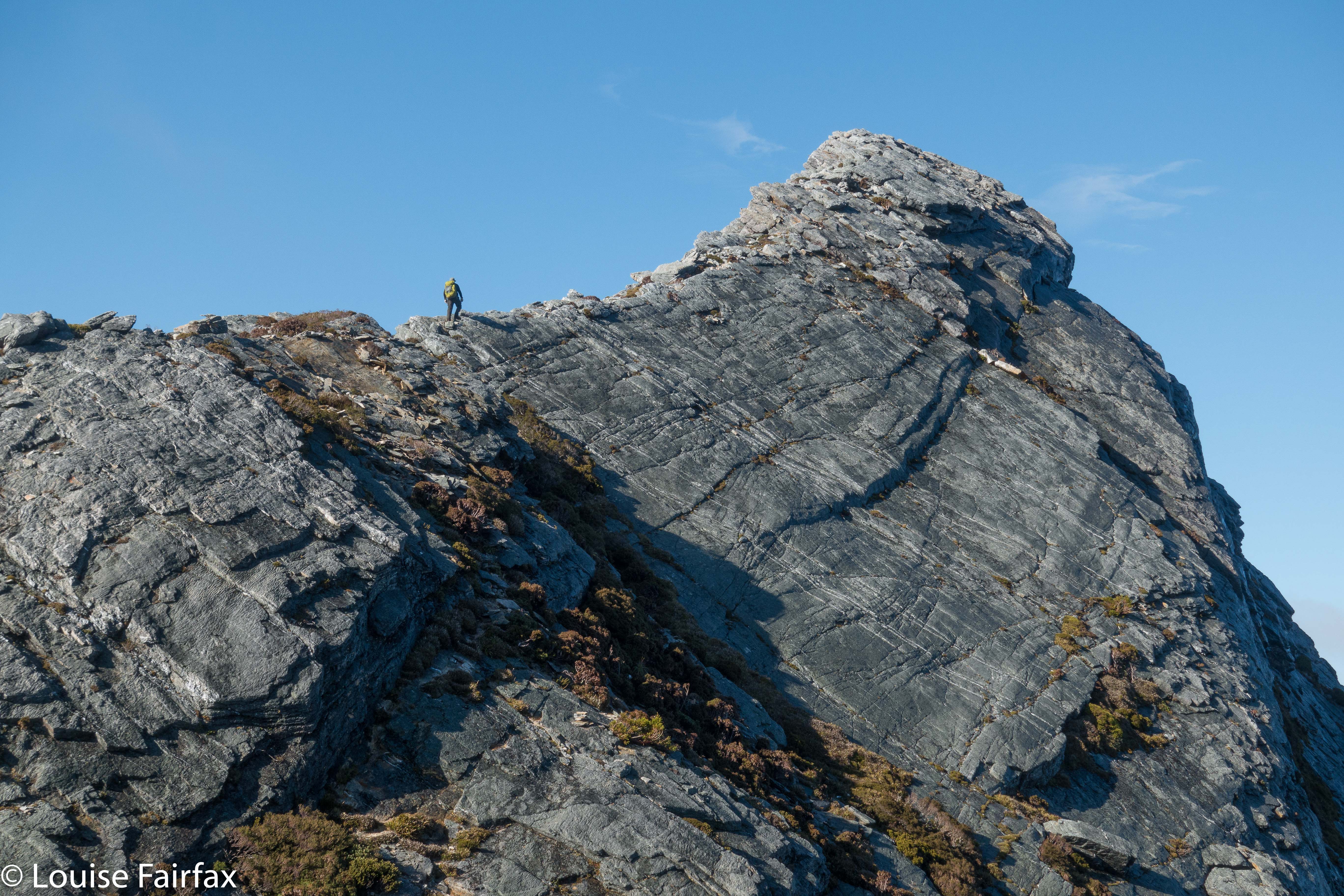
Now I had two big lumps to negotiate before the climb proper began. I was so time stressed by this stage that my memory of these bumps is a blur. My whole focus was on hurrying so as to get to the summit before my turnaround time. My haste meant I didn’t make considered choices, so lost time trying to get off a cliff that was too high to leap from, but had no way around. I gave up, but on the rebound, noted wear marks leading over the edge of a different cliff. Aha. A way down around the obstacle so the climb could continue. On I went, hoping I could remember all this on the way back, when I would be equally stressed for time so as to avoid being up there in the dark.

Weee. I can see Federation Peak – that fabulous fang in tiger distance.
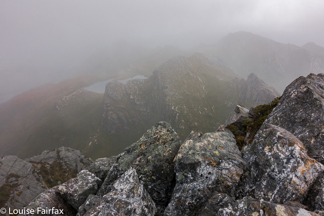
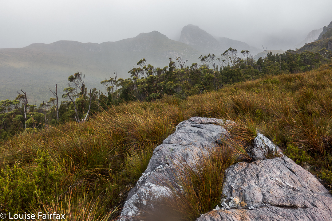
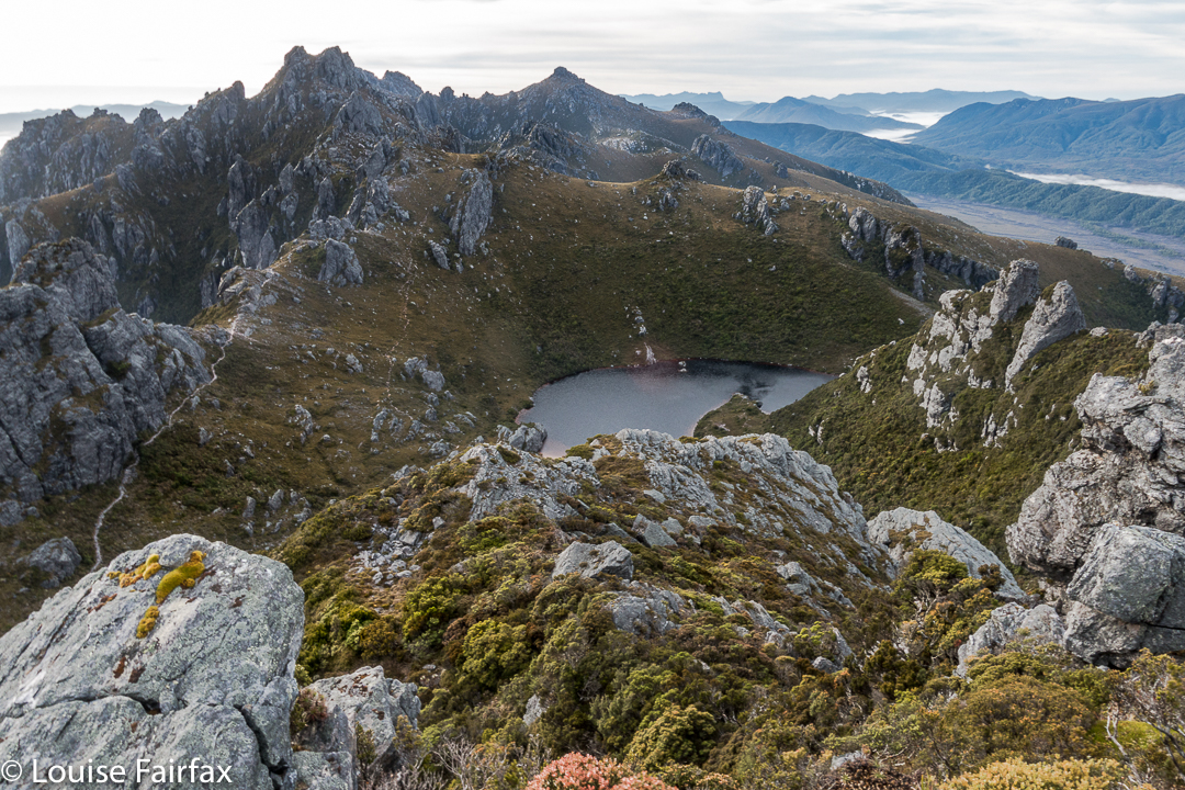
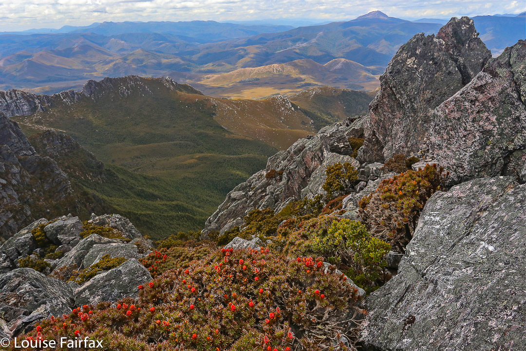
Aldebaran has, it seems, four summits. Excitedly I climbed the first one, ready for jubilation, only to find two more bumps ahead, both of which seemed higher than this one. Grr. More wild dashing. At last, and getting tired now with all this frenzy, I crested the bump. It was 11.50. Oh NO. There was another, bigger bump up ahead, previously hidden behind other rocky mini-mounts. How long would it take to get there? My absolute latest turning around time was 12.30. More rushing. Hoorah. At 12.10 I stood on the summit and there were no more summits. I touched, took a few photos and thought I’d better go. To my horror, clouds, were now floating with a frenzy equal to my own, rising faster than I did up from the valley below and circling around me. I was about to lose my visibility. This was a complex mountain: i.e., this was very disconcerting news indeed. Meanwhile, it was very pretty, so I took a few more photos. Might as well die with attractive shots in the camera for my family to enjoy.

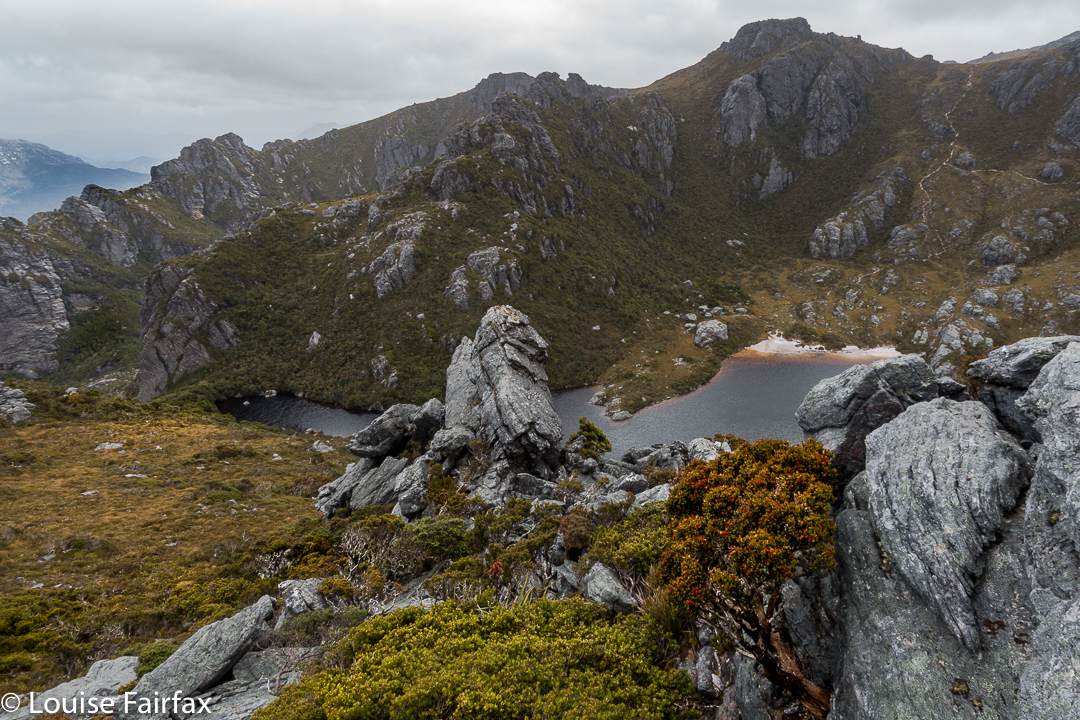
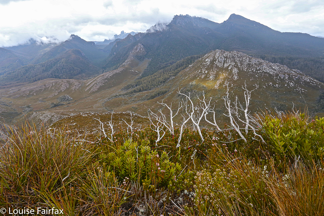
Still climbing. Looking down over Haven Lake to Mt Taurus.


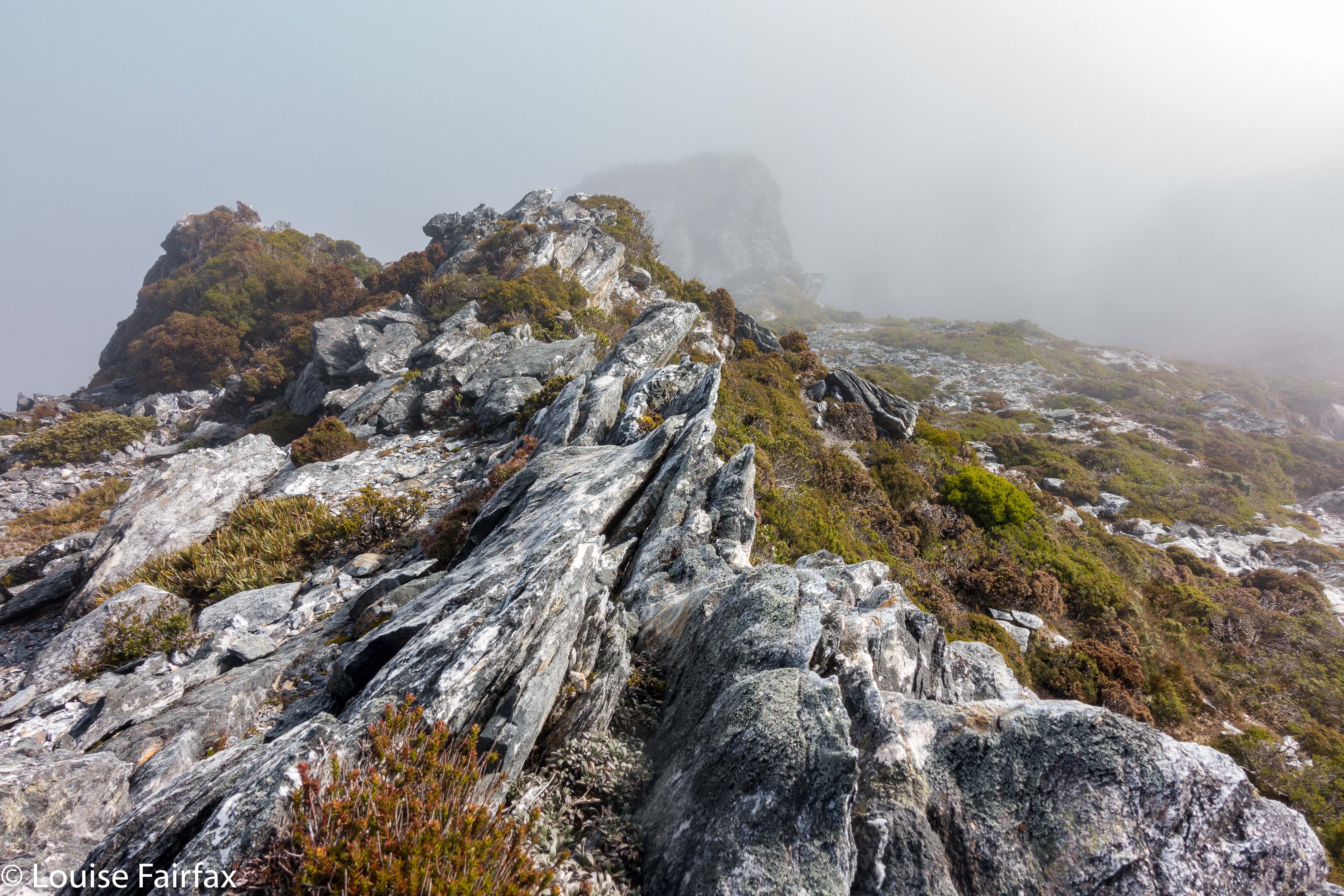
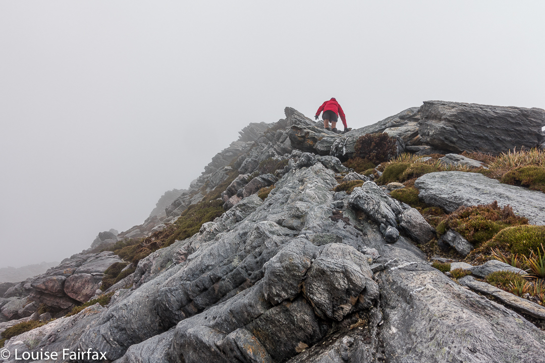
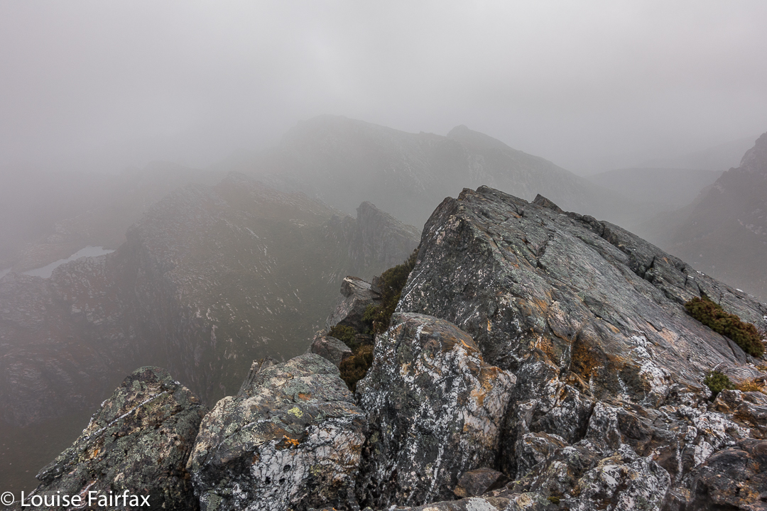
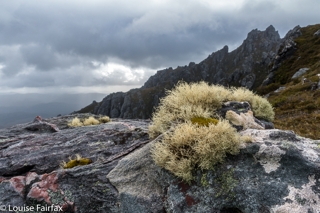
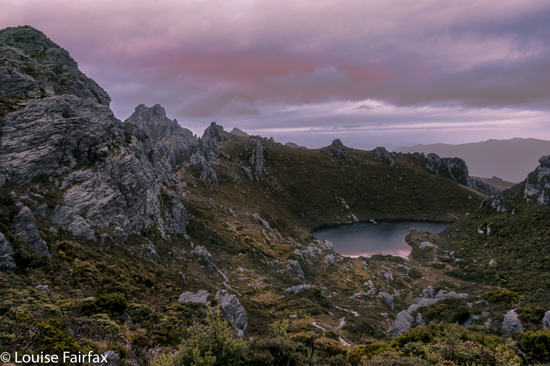
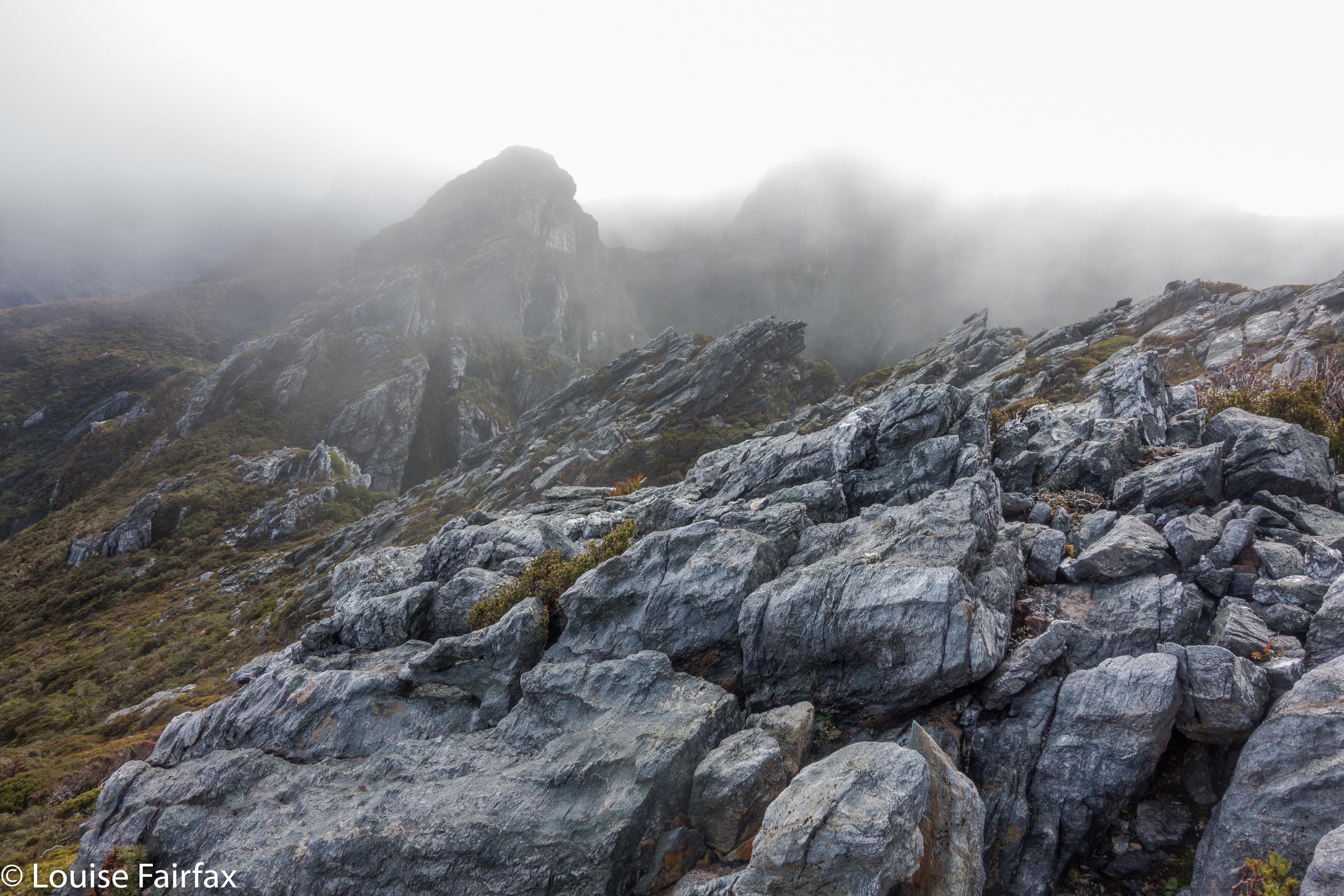
Mist closing in on top.
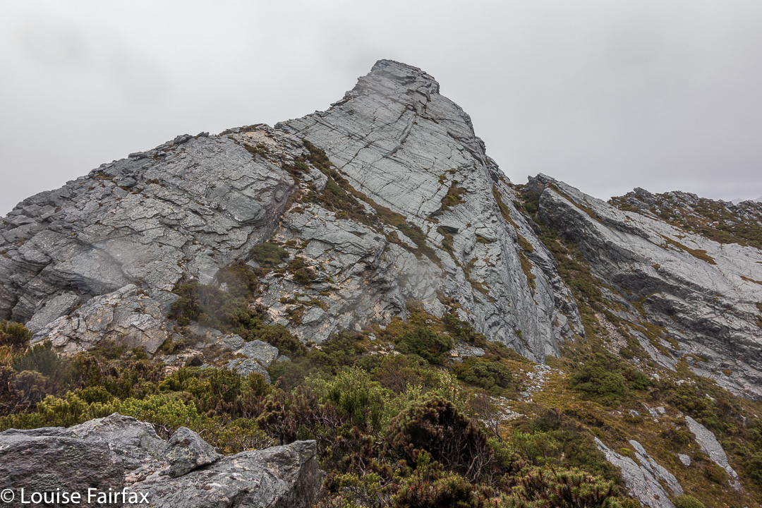
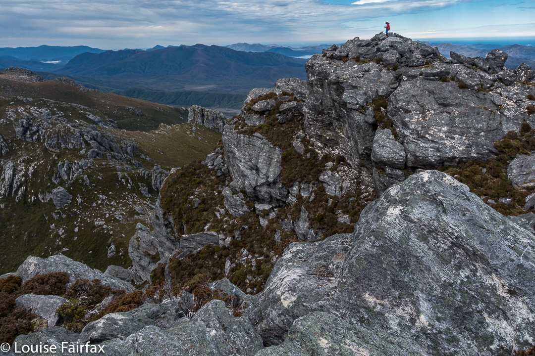
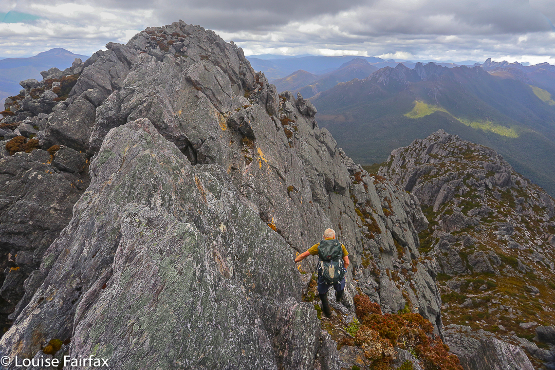
On I went, over bumps and through more saddles, hoping I’d remember my route. At the last of the bumps, I found my friend, so we descended to Sirona together. I’d made OK time back, so the pressure was easing, although A wanted to climb Scorpio. Fair enough, He hadn’t got to climb Aldebaran. He set off while I did some eating, saying I’d give chase. I caught him at the saddle before the final climb, and had great fun photographing his ascent (see below).


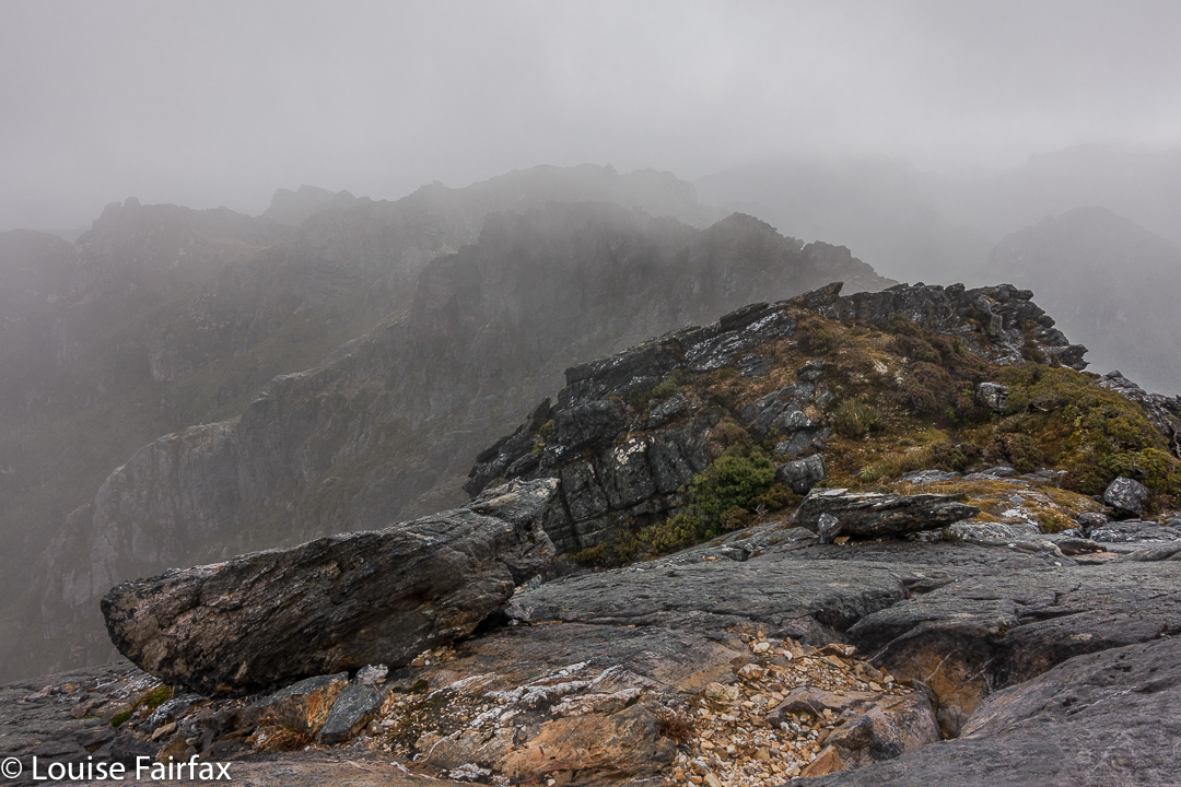
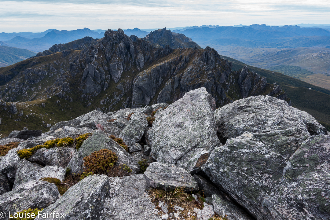
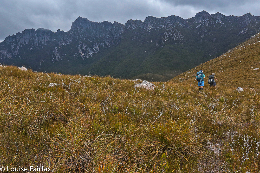
The route ahead. Ahem.
It had been pretty quick, and we were making good progress, so we now had what I felt were heaps of breaks, and lovely long ones, sitting on rocks watching the shadows lengthen and the atmosphere take on aureate hues as the sun dropped. Next day my friend said he would have liked more, and longer, so I guess all things are relative. At least with my being a task-master and time bossy-boot, we got back to the tents with just enough light to gather water before we lost all visibility. It was a beautiful mild night, and we both enjoyed the light and the slivered moon before falling asleep. I closed my eyes even earlier that night. I heard my friend call something about the moon from his tent, but I was too tired to even answer. It had been a long day, and I was finished.

Climbing Scorpio. The mist cleared back again by Lake Sirona.
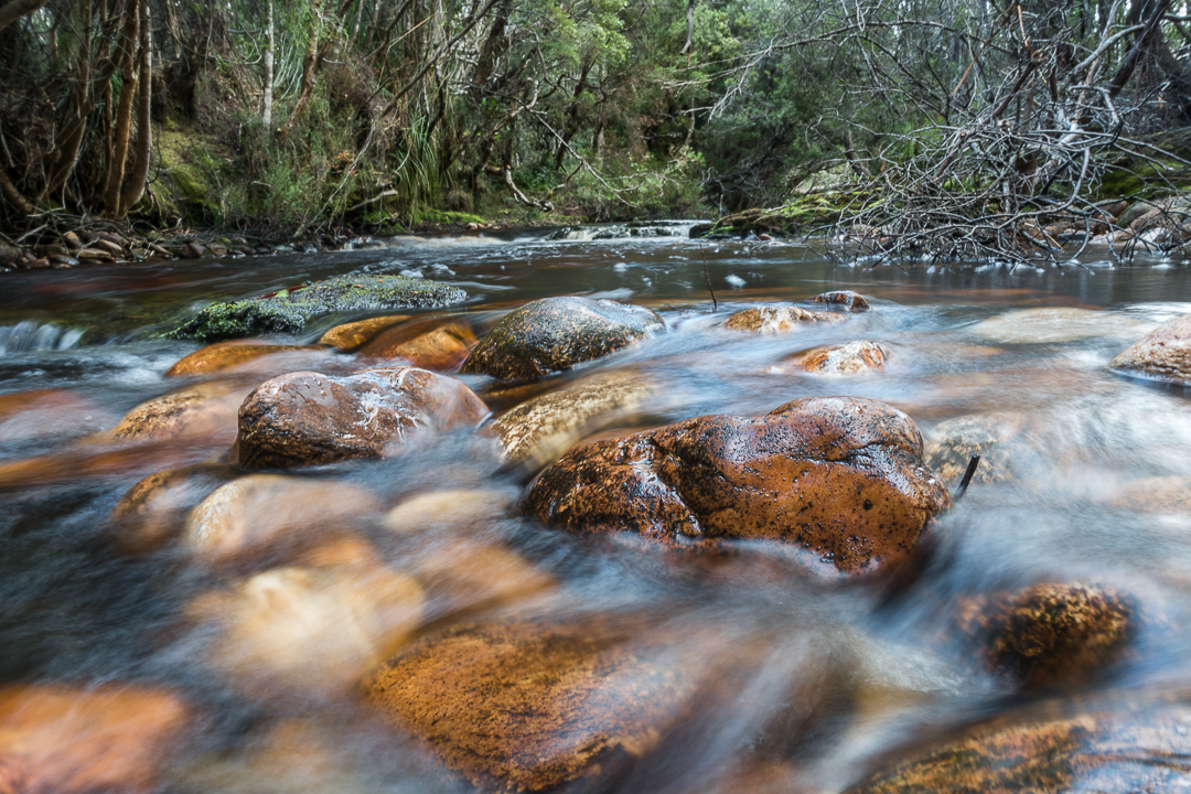
We were both exhausted on the third and final day, and the mud seemed even sloppier and deeper. Several times we were wallowing in it thigh deep. We both became covered in its ooze, but were at the cars by 2.30, which was great, although still, by the time we’d changed out of our black, smelly gear and got going, it was too late for our favourite food places. I drove my friend to Hobart, and decided I’d go back to Maydena and use day four for waterfall and fungi bagging and shooting. I might as well use being south while I was here, and had a doggy sitter for Tessa all lined up, so I should use the opportunity while it was available. It was a good decision, and next day I would visit Tolkien Falls, Regnans Falls and Growling Swallet before the big drive home.

Scorpio 2017 Apr

Mt Scorpio, Apr 2017

Our camping spot, Seven Mile Creek.
Mt Scorpio, stuck out there towards the eastern end of the Western Arthurs, has always had a certain allure. Perhaps it’s Dale Lisson’s photo in the Abels II book, with diminutive, rucksacked figures walking up a knife-edged slope, that gave birth to my feelings towards this mountain, and created a mixture of respect and fear, combined with a  desire to be on it myself one day, and to summit it via that edge.


Climbing Kappa Moraine.
At last I got my chance this Easter. Unfortunately, a different book said not to climb it in wind. Even more unfortunately, the weather whipped up a beauty of a blast, together with mist and rain, on summit day. Oh well. That’s nature. She doesn’t cede to our desires.
On our first day, we had walked in over 20 kms along the MacKay track to Seven Mile Creek. It was not necessary to walk all this way – there is a Kappa shortcut in existence – but we decided we wanted to camp there this time; we’d go up the shortcut on our second visit to the area (we both envisage many visits yet to come). We knew the forecast for summit day was not good, but Angela is a working woman, and sometimes you just have to take what you can get.


We both loved this glimpse of Promontory Lake before the clouds came in. I must go there one day!! And I must climb Carina Peak to its right.
We were quite hopeful as we walked across the plains from our tent site next day (about one hour’s duration). It was cloudy – a little bit misty – but that was all. At last we were climbing, not having a clue if one of the mountains we were looking at was our mountain, or just a kind of prelude to it. We only got glimpses. We could feel the wind increasing, so, short of the top, donned extra layers in case it got wild up there. Good move.


Angela climbing the final stretch.
The Abels book implies that you just kind of walk straight to the top, but when we reached the nearer end, we could see no obvious route up, and certainly not the one of the picture, so I voted that we go to the further end instead. THERE we found the scene I was awaiting. I didn’t want to completely copy Dale’s image, so chose a different angle and asked Angela to please go on so I could photograph her on the dramatic slope. The wind blew more strongly.


Summit “view”.
After she had finished posing for me, Angela ducked left, not enjoying the deadly drop down the cliffs to the east, and heeding the warning not to climb on the ridge on windy days. I followed up at this stage. I saw where she had gone, but was rather enjoying the airy space, and had plenty to hold on to, so kept on the blade. I got to the summit, photographed, wondered where Angela was, and began to descend, hearing her calling  me as I did so. The wind was so strong I couldn’t hear what she said, and neither did she hear my full answer.


When I got back to her pack, and saw she was not there, mild panic set in. (She didn’t want the wind buffeting her rucksack, possibly knocking her off balance, so took it off for the final climb. On the other hand, I wanted my back protected from the iciness of the blast, and thought that if I fell, I’d prefer to land on my pack rather than my bones. If you could see the drop, you would know that whichever part of your anatomy landed first would be utterly irrelevant, and that pack or no pack would be of no consequence at all. Be that as it may, my pack stayed on).


I was unbelievably relieved when I saw her emerging around the corner. Her yell had not been for help: it had been to tell me she’d found a cairned route up that was not exposed at all. She enjoyed her route. I liked the mild adrenalin rush of mine, as there was no real danger if you didn’t let go, and the handholds were firm.
All of those antics complete, it was now 10.30. We decided that, despite the weather, we’d continue on towards Aldebaran. However, with each step, it seemed, the rain got stronger and the wind more forceful. We had to cross a saddle before Lake Sirona, and in this stretch, I was blown a metre to the east on several occasions. It was taking all my might to fight the wind.


The knife-edged ridge from beyond.
Up we climbed, … up a chute which was quite slippery, but doable, and along to another saddle. Ahead in the gloom lay numerous lumps and bumps of unknown difficulty. This next saddle, like the one before it, had huge drops on the leeward side. I was now moving very slowly in my attempt to deal with the effect of the wind and to protect myself from a huge but terminal flying lesson.  I wasn’t moving fast enough to stay warm, despite my multiple layers of clothing. Reluctantly, I told Angela I thought I should quit. She was very obliging, and about we turned.


The way back was windy and wet, but as we got lower, I could move more quickly and thus stay warmer. It was far more fun being out there dealing with wild nature than lying in a cosy tent, that’s for sure. We were back mid-afternoon, and seemed to spend most of the remaining hours of the day eating, calling the food a variety of meal names.


You can see we climbed the final stretch via the “back door”.

Western Arthurs 2017 Jan. More rain + snow


Most of us who love bushwalking do so because we love nature, and one of the things we love about nature is its ephemerality, and its unpredictability. We can never count on a repetition of a beautiful moment. Its adventitious arrival thrills us precisely because it cannot be arranged or designed by us.


We always feel ourselves particularly blessed to have been allowed to see such a spectacle. But equally, and because we do not get to boss nature around, it sometimes throws weather or events at us that are perhaps not what we would have ordered had we been allowed to do so. We have to accept this aspect of nature as well as the parts we revel in – and, in fact, many of us take a perverse delight in the wild side of nature anyway, knowing it’s part of the whole package that we adore.


Those of us on the recent HWC expedition to the Western Arthurs had to take this on board. Our intention had been to traverse the whole range. For several of us, this was not the first, or even the second, attempt at doing this. First, we had to delay our start by two days because it was snowing and freezing up there, making it unpleasant and even dangerous in spots. And then, while we were up there, new weather reports promised a repetition of this, combined with howling winds. This was not a week to be doing tricky climbing, or to be camping up high. We put our tails between our legs, and retreated, yet again thwarted by the conditions. I don’t mind being out-trumped by nature. I like to think humans are demonstrably not as grand and in control as we presume ourselves to be. Perhaps a little more (and helpful) respect for forces greater than ourselves can emerge from such encounters.


So, what are some results emerging from this weather, other than our turning around and doing yet another descent of Moraine A? Well, all the rain preceding our trip meant that the notoriously muddy Port Davey track was in fine form, with excellent depths of black squelch to be fallen into by the unsuspecting walker, thinking that he or she was stepping onto a piece of ground (wet, black, sodden) like all the other bits of ground. Plomp. In they go. Boots, gaiters, pants all became coated in a thick layer of ooze. I couldn’t pull my overpants off when I got hot as mud filled the zip and it wouldn’t move. Oh well. The positive side of this is that carrying water was unnecessary: it was readily available at almost every step of the journey. (Despite this, tent sites were not too squelchy.)


One had to be very careful about where one pitched one’s tent, as the howling winds announced their presence in rowdy terms. The winds changed direction and force during the night too, catching out certain walkers that we met. Everything became just a little bit more difficult.


It was pretty cold for summer. The lakes did not score swimmers. In fact, my beanie was on my head for almost the whole time – day and night. My coat never came off once, and most of every day I wore both my padded coat and my Event Anorak to keep out the wind. I also wore an icebreaker the entire trip.


I would like to say that a positive aspect of this weather was moody mist and dark, interesting clouds. However, I must say that I found the sky difficult to photograph this trip: it was just a little bit too light, and, as I was on a supposedly long expedition, I hadn’t brought my full frame camera with GND filters to darken things down. I struggled to avoid washed out areas.


I didn’t get to climb any new mountains or tread any new paths, but, hey, a party that only has people you know is not a bad party. I reclimbed things, and explored areas that I knew more thoroughly. I also got to meet new people – both in our group, and amongst the others who happened to be camped near us, or whom we met on the track. Some along the track that I met wanted to complain about the mud, but, really, it is not such a bad thing, as it helps keep the numbers down, and to deter many of the people who couldn’t actually cope with the real Western Arthurs, the high, ferocious, untamed bit “up there”. (The severity of Moraine A also helps in this regard). Take away that mud, attract even larger droves of people in there, and the place will be ruined. It’s already overcrowded to a disturbing degree.


In the course of our trip, we encountered a walker without a map, one without any kind of a rain jacket, people using a kind of tarp-shelter rather than a tent, many people who didn’t own thermal or woollen gear but were relying on cotton garments to keep them warm, people who didn’t own down bags, and many, many people who had no idea of the weather reports. This area is too popular for some of its users’ own good, I fear. If you want to visit the Western Arthurs, do yourself a favour and go to a reputable bushwalking shop to discuss your gear, and please also consult the excellent website run by the Bureau of Meteorology, both before you leave, and in high places when up there, so you can get an update. Knowing what to expect, and reacting appropriately to bad reports, is very important. It goes without saying that a map and compass are essential. This is not continental Europe: there are no cute yellow signs up there, and there are no splashes of red and white paint on rocks. When the mist closes in, it is very easy to get totally disoriented, even with a compass! And once the bad weather arrives, you may not even meet anyone who can help you, as they will be either sheltering in a tent somewhere, or they will have cleared out, to try again another time.

Western Arthurs 2016 Feb (in the rain)

Western Arthurs in the rain: Paddy Pallin once wrote words to the effect that one of the aspects of bushwalking he loved was the way it intensified normal existence (my words) and made him newly appreciative of life’s little pleasures. A glass of wine by an open fire is twice as good after a period of deprivation. A bushwalker never takes the joy of a hot shower for granted. The simple things of life retain their power to delight.

And so it was for Angela and me as we sat in The Possum Shed having lunch yesterday. Once we’d descended Moraine A, Angela looked at her watch and announced we could make it to Westerway for lunch. I agreed. She was away, splashing through all the puddles, not caring about mud holes. Zoom. I trotted behind, somewhat laden with my tripod, glass filters and heavy camera. Our packs were now weighty with all our wet gear, but that did not deter. The thought of real, hot, delicious food, consumed in pleasant surroundings spurred us on. It certainly felt good to be there at last and announce to our husbands that we’d be home early. During the night, I had greatly feared that the river at the track junction would be uncrossable, so much rain had fallen, so was doubly relieved. We might have been there for days; I had saved food accordingly.

This trip marked the end of Angela’s long summer holiday. She’d taken a month off work so as to climb Federation and do the whole Western Arthurs Traverse. Through a series of mishaps – disappointing cancellations, fires, bad weather and injuries – these hopes had been greatly diminished. We had still done a number of great climbs, but not the ones intended, and now the Western Arthurs were being reduced to a mere three-day expedition due to weather and my dubious foot. Angela has not explored this region, so was excited even by the reduced agenda. Now she has been there but seen next to nothing.

Unfortunately on day one, Angela was adding another chapter to her book on Summits to Spew on (it had been very hot climbing), so I killed the hours at my disposal once we had selected our campspots, climbing lumps and bumps and photographing, although the light was very dull and flat. Disappointed, I retired to my tent, and watched the grey, matt landscape as I cooked and ate dinner, before going back out to try my luck – returning with a few shots that didn’t match my expectations. I sat staring at the scenery in a trance, waiting for darkness and bedtime. I had by this time, of course, packed up my tripod and GND filters, and put my camera to bed. Suddenly, a flash of colour penetrated my vague awareness. Mt Hesperus was aglow with the final rays of the day which had somehow (and most unexpectedly) pierced through a hole in the thick amassing cloud.

I had no time to alter settings or do anything. I grabbed my camera and shot and hoped. It lasted. I quickly changed ISO, f-stop, exposure and shot again, a woman possessed. It was still there. I had to get outside. I grabbed my boots, no time for laces, and shuffled outside to face the west. There was no time to set up, so I used a passing rock as a tripod and hoped for the best, sighing at the wasted effort of lugging all my equipment up moraine A to now have it sitting in my tent in my moment of need. The sudden flash of colour had woken Angela, so she joined me to share the beauty, and take pleasure in the fabulous scene that was our gift that evening.

By the second day, the rain had set in, but we donned our gear and headed for mountains to climb. The heavy rain, gusting, strong wind, slippery rocks and dark gloom changed our minds regarding our purpose, and we turned our spree into a walk to Square Lake and back. It was time to enjoy the minutiae of nature. The pinky-grey quartzite, green cushion plants and dislimned shapes that appeared and disappeared as we progressed gave us pleasure. It was nice to be moving. The denizens of the ten tents at Lake Cygnus were all tucked up in bed, but that is not our style. The price we paid for our excursion was to return to the tents drenched. Thoroughly, hideously sopping, I peeled off my disgusting layers, dropped them on the floor of my vestibule, and entered the dry inner sanctum of my aegis. After some effort, I was in dry clothes, snug in my sleeping bag, eating lunch with one hand poked out into the open, hoping that Angela didn’t want to begin our journey out after lunch. She didn’t. We spent the afternoon contemplating the existential pleasure of warmth and dryness.

On the third and final day, it was time to put on those tossed, detested items of clothing, a thought that had plagued me during the night, when I wasn’t practising drowning at the hands of a swollen river. It rained while we depitched, but things couldn’t get any worse. Rain was now, quite literally, water off a duck’s back. The track was a ribbon of water, across the grey-green moor, and two sodden girls went walking, walking, walking, two sodden girls went walking, right to the mountain door.


West Portal in Three Days 2015 Oct

“West Portal in three days Mark? You’ve got to be kidding.”
“Oh well, we’ll pack for four, but hope for three. I reckon we can do it.”
I’m glad he was confident. I’d try my best. Let the tale begin …….
Day One.
“We’re here,” I heard Mark say up ahead. Apart from hearing my husband or daughters say “I love you”, these felt like some of the best words I have ever heard in my life. Electric shock tingles were coursing across my left shoulder from the weight of my pack; the ball of my right foot felt bruised; my socks had bunched up at the front of both my boots causing discomfort; my hips felt very tender and I was, quite frankly, tired.
We’d walked 27.4 muddy kilometres in 8 hrs 52 mins, within a total ten hour timespan. That’s a lot of work and not much rest; but at last Mark’s words meant it was over for the day. It was still nice and light. It actually hurt to remove my pack from my aching shoulders, I was so stiff. Like wooden dolls we tottered down to the Cracroft River at the crossing where we were camped to admire its beauty and collect water for the next few meals. It was time to relax.

West Portal trip Day 2. Crossing Strike Ck

I pitched my tent, slowly, partly because I could barely move, and partly to try to accustom myself to its little ways (it’s relatively new), before joining the other two for soup. Oddly enough, at a mere 8.15 pm I thought the idea of turning in for sleep was exceptionally appealing. You don’t often find me in bed at that hour. I impressed the other two with the size of the two large pink swollen lumps I had – one for each hip bone – before I disappeared. Sleep would be like a divine ambrosia.

Day Two.
This was to be the day on which we attempted the summit. I wasn’t confident of my own ability to do this, but it made me feel better to hear the other two say they were tired too. At least we’d be in a similar situation. However each of us felt as individuals, we were there to give this our best shot. I set small goals: it would be great to see Lake Rosanne; marvellous to reach the high point on Lucifer Ridge; amazing to walk across the Crags of Andromeda; and, well, let’s not get disappointed by thinking about that far-off, hideously high summit, buried in the clouds right now. One step at a time.

Lucifer Ridge is gained

We still had another hour and a half along the flats before we began our climb proper. Over the Razorback Range we went, dropping into the squelching, muddy Arthur Plains, which we followed until beyond Strike Creek. We took the hypotenuse shortly after crossing it, heading up to the first high bump on the Lucifer Ridge, which jeered at us from above, as its namesake would also no doubt do. The gradient was so steep that the land was almost in our faces. We pulled on tufts of grass to yank ourselves up. Once my body started screaming, I led us on a kind of slaloming zigzag to lessen the severity a bit.

Lucifer Ridge view

With relief we crested a mini bump on the way to the one we wanted – some rocky wart – and took a two-minute breather before continuing on to meet the point where the vague pad from the longer ridge rose up to meet us. Every down was resented as it meant a loss of hard-earned altitude; every up endured with pain until we gave ourselves another tiny break to enjoy the view. We couldn’t rest for long, however, as our goal, although getting easier to see, was still a long way off. However, when the delightful Lake Rosanne appeared below us, we had to stop and admire her. We had a drink and muesli bar and took a time split at this point, as a pad came in on our right, coming to us from the lake. We’d done nearly two hours’ climbing since leaving Strike Ck.

On Lucifer Ridge

For yet another hour we climbed steadily (except when the wretched pad dropped to get around cliff lines) and steeply. We were nearly at the top, but we found a puddle of water, and I was starving, so we called another break and had a drink and snack before continuing. I stole some savoury food from my lunch rations, as muesli bars were not doing it for me. All of a sudden I had energy again. Let’s go!

West Portal from Lucifer Ridge. Oh dear. It still looks a long way away and we have already been working for hours.

We “topped out” a mere eight minutes later, entering delightful “sound of music country”: a wide, open ridge with short grass and expansive vistas in all directions. We could see the Western and Eastern Arthurs, the Mt Anne Range, Lake Pedder, Mt Picton and more. It felt like we could see everything. I dropped momentarily behind to take a few photos and hastened to catch up. Today was about the summit, not about photography, and too much of the latter could scupper our chances of the former.

Topping out at the Crags of Andromeda

On we hastened – if rushing snails can ‘hasten’ – for another hour and a half (nearly), travelling over the Crags of Andromeda and via the first, false summit (excitedly assuming it was “the one” until we saw the challenger to the throne a bit further on) to that glorious cairn that was ours. At some point in there as I traversed the Crags, chasing the others as I’d been indulging in a little more photography, I realised we were actually going to make it. A tear trickled down my cheek, I was so overwhelmed. The only other two mountains I’ve cried on have been Ossa because the view was so beautiful at sunset, and Mont Blanc, which I’d circumambulated, because I was – and still am – madly in love with her huge white magnificence, and I was grieved to leave her.

That’s her, the summit of West Portal: the highest thing you can see ahead. At last we’re closing in – but there’s an impassable gulch between summit B that we’ve just visited and the one we want. We need to go down to get up.

This mountain here has a special aura for me, and I had not conceived of success. People who have climbed her have always seemed to me to be “real” bush people: accomplished traversers of the challenging Tasmanian wilderness, and mostly (but not always) males. I couldn’t believe that I was going to stand on such a summit. I know there are much harder mountains to climb that lie in wait for me (they seem to me right now to be impossible), and I am not trying to claim anything for myself here; I am just saying the effect this particular icon had on me.

West Portal Summit. Richea scoparia enjoys some of the best views scoparia can have anywhere.

We ate our lunch on top, oggling at the wonderful view in every direction around us. This is the highest peak in the Western Arthurs, and it commands a vista commensurate with its title. I particularly loved the rugged Crags of Andromeda with their dramatic weathering patterns; of course, we delighted in the cornucopia of peaks with jagged edges bespeaking nature’s infinite power and fury. It had taken us 6 hours (and four minutes) to summit. We’d now relaxed on top whilst eating. Mathematics said it was time to turn our heads concertedly for home.

Lake Rosanne seen from the way down

Luckily, we descended more quickly than we had climbed, having ironed out a few of the glitches in our approach. Angela had brought her jetboil, so once the pressure was off – near Razorback saddle – we all had a cup of soup to fortify us for the last leg home. We arrived at the tents as darkness fell. Any later and we would have needed those headlamps we’d been carrying all day. The climb had taken us a total of 11 hours 40 mins’ walking plus food breaks added on. We’d covered 27 kms again, only this day we’d also climbed 1,000 ms (= 37 km equivalents) in tough terrain. Three exceptionally satisfied friends sat in a circle cooking and eating dinner. We were not looking forward to the long day on the morrow, but we all had four days’ gear with us, so if we couldn’t manage, it didn’t matter; we’d just camp at one of the many creeks along our 27.4 km path.
Day Three.

Cracroft Crossing campsite on the morning of day three. A nice misty day to begin with, but it became clear and hot later.

We didn’t need the extra day. We took fifteen minutes more walking time to reach the car on the rebound, and our breaks were longer, mostly to please me. My shoulders would not have gone the distance otherwise. We cooked soup to make lunch more interesting and relaxing, and had a cup of tea before the final long leg from Junction Creek to the car. I even went wading. It was wonderful sitting beside amber creeks in green groves with the friends with whom I’d just shared so much, soaking in the bush with the satisfaction of having achieved our goal. This is the life.

Seven Mile Creek, a refreshing food stop place

The route. Overall,  we covered 91.8 km equivalents, in three very tough days.